|
Canadian Railway Tunnels
and Snow Sheds
|
|
|
|||||||||
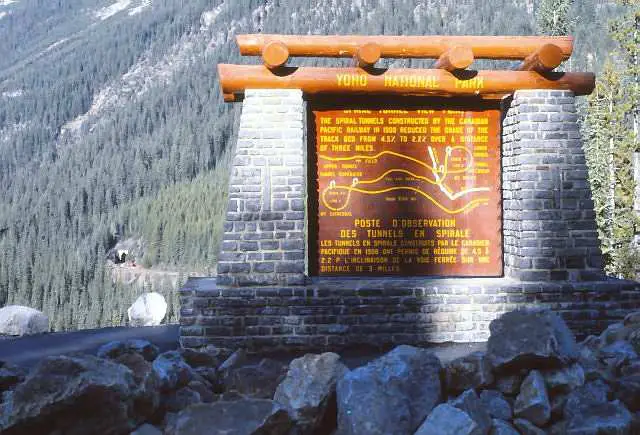 |
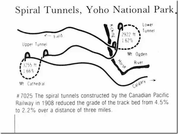
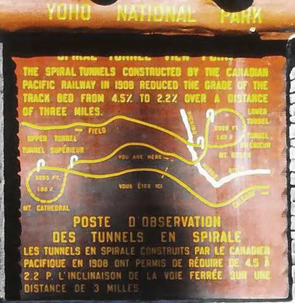
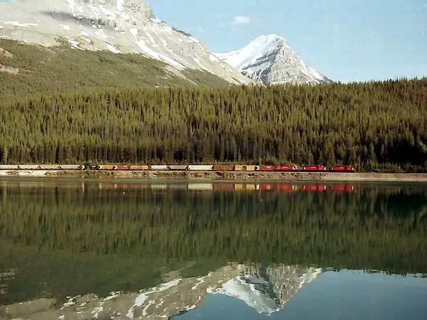
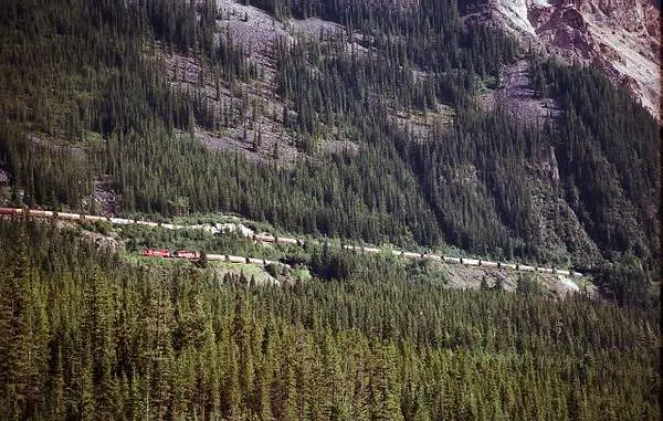
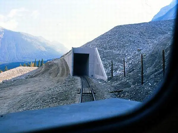
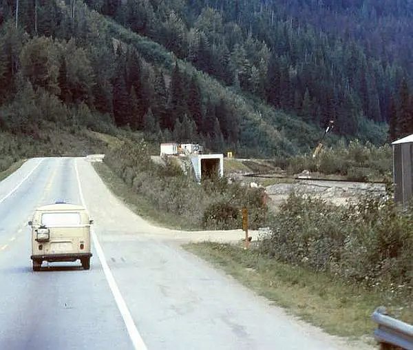
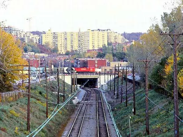
The marker at the viewpoint pull-off along the highway,
between Lake Louise and Field, showing the layout of the CPR Spiral Tunnels. Its located on a very sharp 10-mile descent full of curves and provides drivers with a much needed rest about half-way. In the background, the top portal of the Lower Spiral Tunnel. Taken late afternoon around April 1985. In order to understand how the CPR Spiral
Let's visualize a train coming along the top line from
|
||||||||
| This picture was taken and submitted by Massey F. Jones | |||||||||
 |
Next, following the diagram, the train proceeds to
the middle line on the map and passes in front of the viewing point (marked "You are Here'). Normally at this time, most trains sound the horn. The next best thing is to turn around and face away
A much better option for rail photographers is not to
Reverse the procedure for westbound consists. After
The crew change is at Field, leading to a few more
As a rule, if the track is clear, traffic calls for about one
|
||||||||
| This picture was taken and submitted by Massey F. Jones | |||||||||
|
The Canadian Pacific Spiral Tunnels are located a short drive west
of Lake Louise AB and east of Field BC in the Kicking Horse Pass
of Yoho National Park at 5,390 feet (1,643 metres). The driving distance
between Lake Louise and Field is 30.4 km (28 minutes) on the Trans-Canada
Highway.
The Spiral Tunnels replaced "The
Big Hill", constructed in 1884, which saw several derailments on the
4.4% downhill grade. Pusher locomotives had to be used to bring trains
up the hill. Several safety switches were built on the Big Hill so that
downhill runaway locomotives could go into the turnout, then up a small
uphill grade for a while and decelerate to a stop. Traces of them still
exist.
http://en.wikipedia.org/wiki/Big_Hill
The Canadian Pacific Laggan Sub runs between Field and Calgary, a
distance of 136.6 miles. Regular CPR intermodal and unit freight trains
use the tunnels in both directions. The frequency through the Tunnels when
busy is about one train
Going through the Spiral Tunnels by regular passenger train is no
longer possible except with the Rocky Mountaineer train from May to October.
Instead, VIA trains run on the more northerly route through Jasper
on the way to Vancouver, through Kamloops.
|
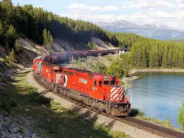 |
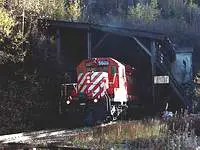
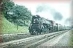
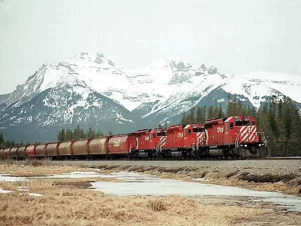
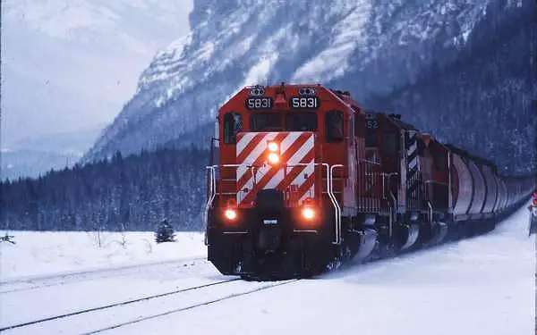
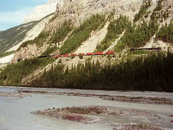
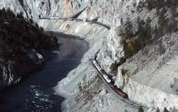
Canadian Pacific Railway had well over 500 of these
SD40-2 locomotives, capable of high speed and great traction effort. Even today, many of these soldier are used as either
CPR 5976 and 5810 are seen, at the start of the
The shot is taken at the Great Divide, almost below
|
|
| This picture was submitted by Massey F. Jones | ||
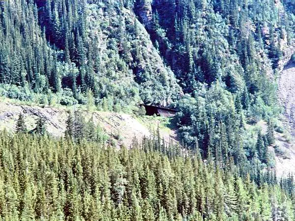 |
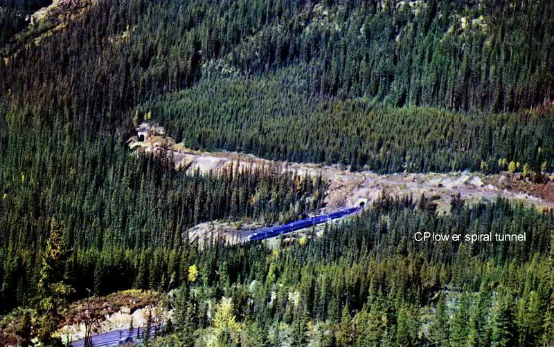
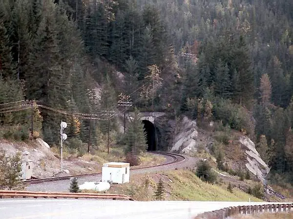
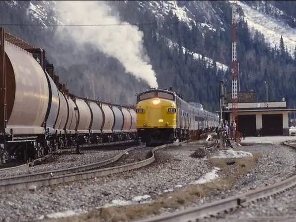
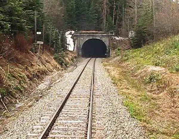
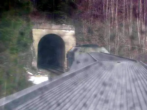
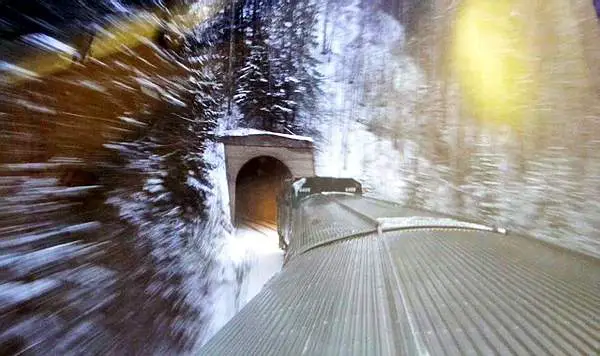
The top portal of the Spiral Tunnel at Mileage 128.8
CP Laggan Sub, viewed from the Trans-Canada Highway, about 300 ft. (92 metres) below, in the late 1980s. The Spiral Tunnels were opened in 1909 and have seen steady 24/7 traffic through ever since, to this day. There is an average of one heavy haul train through
|
|
| This picture was submitted by Massey F. Jones | ||
 |
This photo was taken by merely standing alongside the Trans-Canada
Highway and waiting for the train, as it
slowly moves forward along the south shore of Wapta Lake close to the Alberta/BC border. Be aware, that Wapta Lake is covered with ice until
|
|
| This picture was submitted by Massey F. Jones | ||
 |
As the train draws closer. additional photos become
possible. This photo looks to be taken deep in the mountains but it is about 300 meters away from a busy Trans-Canada Highway. The harvest season is now over and the first snow has
|
|
| This picture was submitted by Massey F. Jones | ||
 |
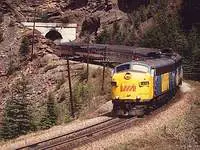
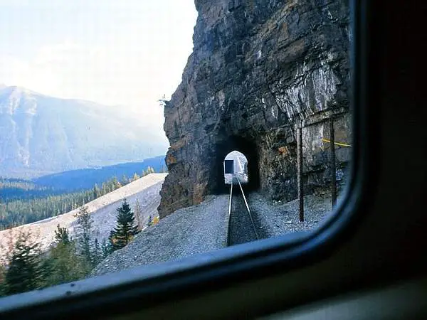
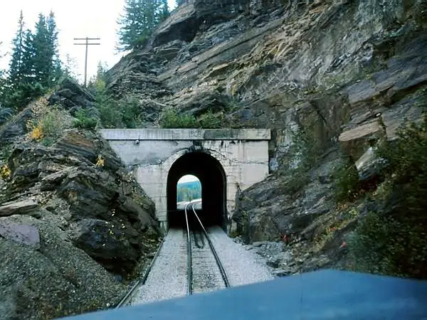
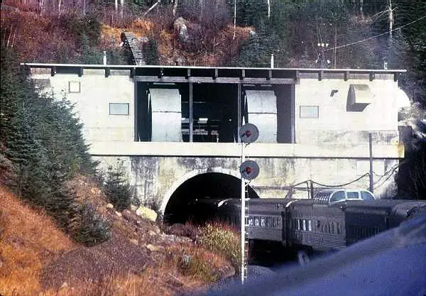
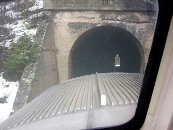
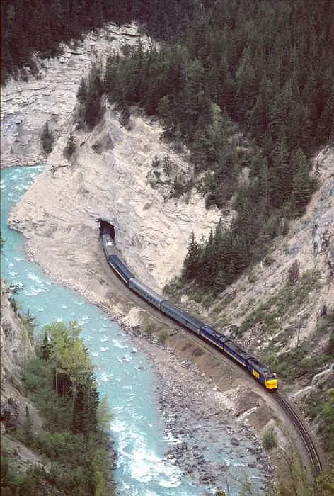
The lower portal of Upper Spiral (Number One) Tunnel in Yoho Park
BC, showing VIA Rail "The Canadian" from Calgary about to pass through.
Notice the steep angle, at which the train is descending what was formerly called "The Big Hill", with a grade is 2.2% and the curvature is 228 degrees. The difference in elevation between the upper and lower portals of Number One Tunnel is 14.4 meters (about 48 feet). Next, the train will go under the Trans Canada Highway, enter
the upper portal of (Number Two) Lower Tunnel, before exiting at
the bottom.
VIA Rail service through the Spiral Tunnels ceased in January 1990. |
|
| This picture was submitted by Massey F. Jones | ||
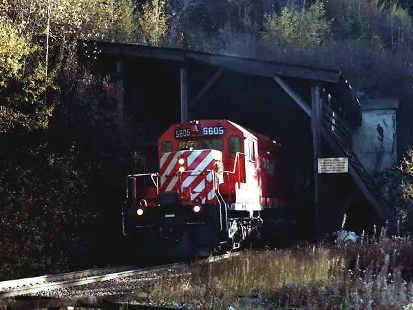 |
CP5605 exiting the top portal of the Upper Spiral Tunnel
in Yoho Park on the Alberta BC border, in the mid 1990s. This is a view rarely seen, except by those who hike there; some 300 vertical feet above the Trans Canada Highway . The train is heading east to Calgary after passsing through the Lower Spiral Tunnel. Built in May 1972, along with a great deal of its sisters,
|
|
| This picture was submitted by Massey F. Jones | ||
 |
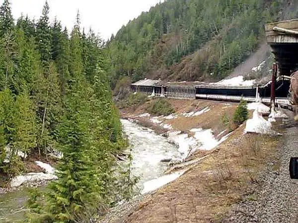
Hidden in all those trees is a train wending its way from
Calgary to Vancouver through the Number One (Upper Spiral) Tunnel. The upper portal can be seen on the far right, while the lower portal is about centre. A view often neglected by most visitors to the Spiral Tunnels, some 300 feet above the Trans Canada Highway. The train is now descending towards the Number Two
|
|
| This picture was submitted by Massey F. Jones | ||
 |
CP's "Canadian" entering lower spiral tunnel
in the
Kicking Horse pass c.1955 (Westbound) |
|
| This photo was submitted by Arthur Grieve of Winnipeg MB. | ||
 |
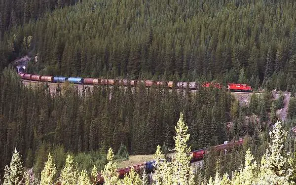
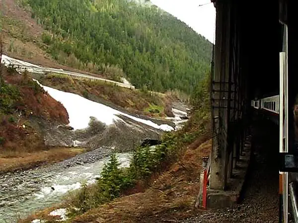
Many photos of the Lower Spiral Tunnel don't show
the 50-foot grade separation as well as this one, taken during the summer in the mid-90s, just short of the lower portal. The consist is a eastbound unit train of empty grain cars making its way back to the Prairies from a Vancouver-area seaport. |
|
| This picture was taken and submitted by Massey F. Jones | ||
 |
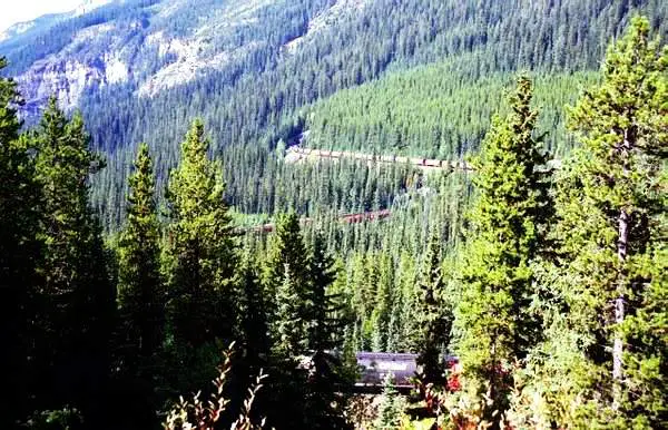
An eastbound CP Unit grain train, shot from the Spirals Tunnels
viewpoint, on the Trans Canada Highway; near
the Alberta/BC border. The shot was taken late in the 1970s. This view is no longer available and you can clearly see the train on 2 tracks. Right now, the trees are so highthat people just glance at the train through a maze of trees, after coming all the way there and really just see a bunch of trees with a train windingthrough them; not a clear view at that. Also, you can see the exit of the upper portal of the lower spiral tunnel quite well. It takes about 140 or so cars to see both ends of the train |
|
| This picture was taken and submitted by Massey F. Jones | ||
 |
|
|
| This picture was taken and submitted by Massey F. Jones | ||
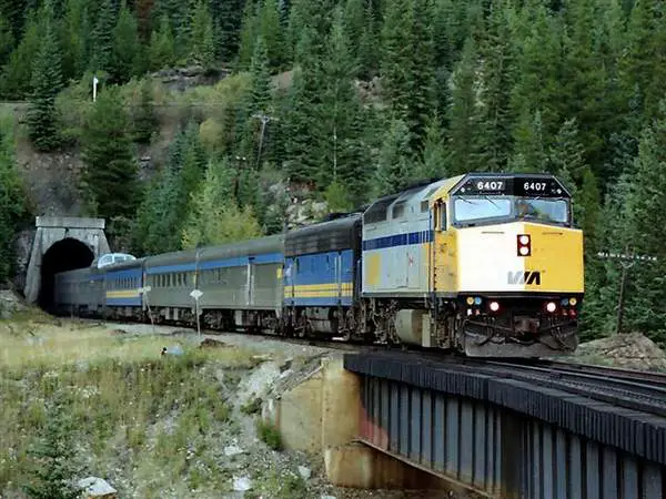 |
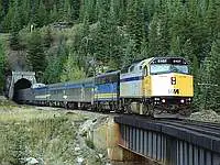
This steel bridge is situated at the exit of the lower portal of
the lower spiral tunnel. Above the tunnel portal is the upper track, barely
seen through the trees VIA 6407 is leading "The Canadian" west over the
bridge, which is the last step for trains within in the spiral tunnels
complex. Unfortunately, VIA ceased to go through the area in January 1990
and was replaced that summer,by the Rocky Mountaineer; a private company
operating luxury trains on a 2-day daulight-only trips.
Photo taken in the late 1980s This train is westbound |
|
| This picture was taken and submitted by Massey F. Jones | ||
 |
This picture shows the caboose on the bridge and the lead
units of the train emerging from Spiral Tunnel No.2 on Field Hill. This train is westbound |
|
| This picture was taken and submitted by Larry Buchan | ||
 |
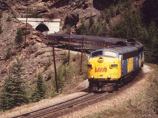
East portal of the short Yoho tunnel viewed from the
Trans Canada Highway, the opposite side of which westbound VIA 1418 has emerged in another photo above. The railing in the lower left is the start of an overpass over the track,to and from the lower Spiral Tunnel. All trains go through this tunnel, either immediately before or after winding through the Spirals. |
|
| This picture was taken and submitted by Massey F. Jones | ||
 |
After westbound trains have left the Lower Spiral Tunnel, they pass
through this short tunnel before reaching Mount Stephen, and starting a
steep descent to Field of what has been called "The Big Hill" http://en.wikipedia.org/wiki/Big_Hill.
Taken about 1976. This train is westbound |
|
| This picture was taken and submitted by Massey F. Jones | ||
 |
VIA #1 "The Canadian", westbound for Vancouver through
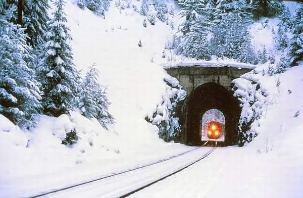
Mount Stephen Tunnel. VIA who ceased operation from Calgary to Vancouver in January 1990 and no longer uses the tunnel. Mount Stephen Tunnel was blasted through, when the CPR mainline was laid, way back in 1885. CPR mainline train still passes through daily east and west. The tunnel is also used by the Rocky Mountaineer, as well as the Royal Canadian Pacific excursion train during summer. It is is 1,400 feet (430 m) and situated in a fairly rugged area, about 2 miles west of the famous Spiral Tunnels in Yoho Park, BC. A couple of wooden snowsheds preceded and followed the tunnel, as the area is prone to avalanches and rockslides. There have been minor improvements made around in recent years, such as slide detector fences and concrete sheds to replace the wooden sheds. This view was taken about half way between the Spirals and Field, from the Trans Canada Highway with a 200mm telephoto lens, around 1988 |
|
| This picture was taken and submitted by Massey F. Jones | ||
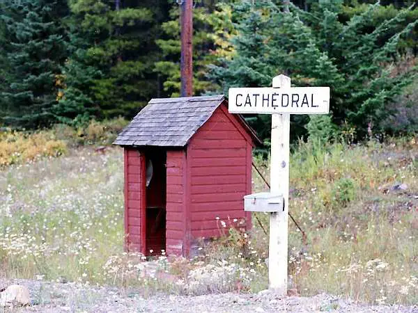 |
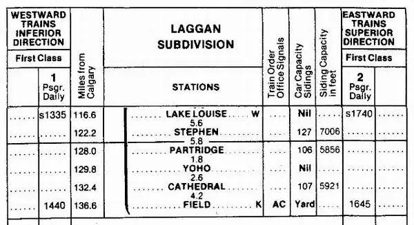
The "station" and station board at CATHEDRAL,
Mileage 132.4 of the Canadian Pacific Laggan Sub, just short of the famous Spiral Tunnels lower portal. From Field eastbound (up the Big Hill), mileages on the
Still going uphill, YOHO is at 129.8; then #1 Tunnel (upper)
128.8 and finally PARTRIDGE 128.0 , where the track more
A double track begins/ends at STEPHEN, Mileage 123.1
|
|
| This picture was taken and submitted by Massey F. Jones | ||
 |
The train then comes out to Field, still descending the
Big Hill, after passing through Mount Stephen, always on the downhill. |
|
| This picture was taken and submitted by Massey F. Jones | ||
 |
West Field BC VIA at the end of the Big Hill | |
| This picture was taken and submitted by Massey F. Jones | ||
 |
Climbing up "The Big Hill", eastbound from Field BC on
the CP Laggan Sub, the first tunnel encountered is the Mount Stephen Tunnel, (also called the "nose tunnel" because of its shape). In former days, trains would have passed through 2 wooden snow sheds, now demolished but perhaps still shown in some pictures on this page. To the left, the Yoho Valley, with the Bow River about 300 ft below. The Lower Spiral Tunnel is just about to the centre of the photo but first of all, the train must pass through the rock shed showing through the tunnel, and then one more. We are now at 5,390 ft (1,643 m) above sea level and rising some more, with Lake Louise a few miles down the line, being the highest point at 1750 m (±5,742 ft). |
|
| Massey F. Jones collection | ||
 |
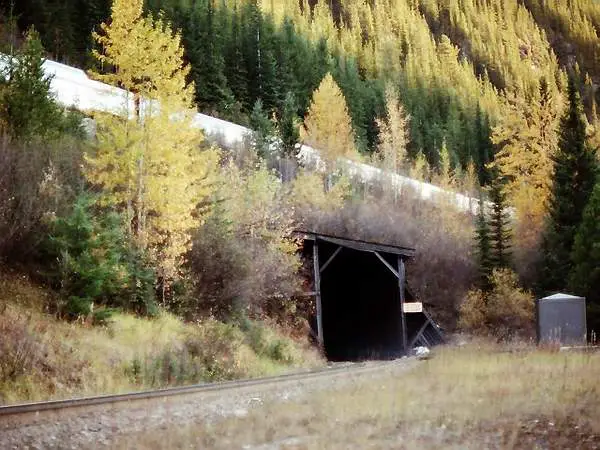
There used to be a wooden snowshed here but around
1987, a concrete one was built instead, because trains pass one of the worst avalanche areas in the Yoho Valley; with a rock fall about 80 metres wide and a kilometer long. One of the pictures elsewhere on the page shows it as a big white strip. The concrete snowshed was built while trains continued to circulate on an adjacent track, then the rail was realigned to match the new one inside the shed and the old line removed. The tunnel is 184 metres long (about 600 ft) and designed for eventual electrification. |
|
| Massey F. Jones collection | ||
 |
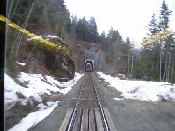
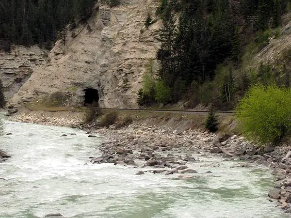
Going through this small tunnel at Mileage 133.1 starts
the run into the lower portal of the No2 (Lower Spiral) tunnel after passing under the Trans-Canada Highway. Various views from both sides of this short tunnel are seen elsewhere on the page. |
|
| Massey F. Jones collection | ||
.jpg) |
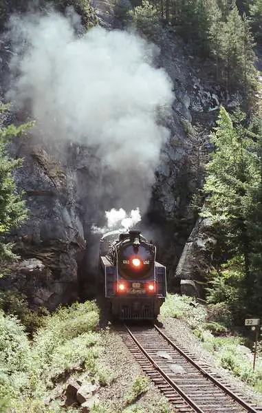
This mid-90s view shows an eastbound train passing
through the Mount Stephen Tunnel, a short distance west of the Spiral Tunnels. Because there are 4 units, the train is at least 150 cars long. It's on the way to Calgary and will the Spirals first to give it the necessary rise in elevation of about 600 feet. (The Lower Spiral will be first) |
|
| This picture was taken and submitted by Massey F. Jones | ||
 |
To the extreme left of this picture is the white
avalanche-prone area at the foot of Mount Stephen in Yoho National Park, which caused the CPR many headaches especially in recent years with frequent rock slides or snow slides on the line. Around 1987, the railway decided to construct a 184-meter (about 600 foot) long concrete shed. So as not to interfere with transcontinental operations, the shed was built in precast concrete sections brought by rail beside the existing line and the track was realigned on completion. Some of the engineering involved levelling the entire area including
the two snowsheds pictured, dating back to the construction of the line
in 1884. This view from the Trans-Canada Highway between the Spiral Tunnels
and
For a good view of the west end of the concrete shed go to:
|
|
| This picture was taken and submitted by Massey F. Jones | ||
 |
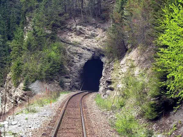
The short tunnel at Milepost 133.1, just west of
the Spiral Tunnels |
|
| This picture was taken and submitted by Massey F. Jones | ||
 |
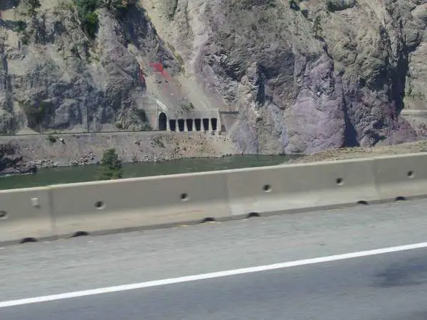
The East Portal of Connaught Tunnel in Rogers Pass BC,
at 51º 19' 50" - 117º 26' 50"; viewed eastbound from the rear platform of the Rocky Mountaineer train on May 11th, 2009. When it opened in 1916, it was the longest tunnel in North America, being double tracked. Westbound traffic required extra "pusher locomotives", based at ROGERS. Upon completion of the Mount MacDonald 91 metres below,
The Connaught Tunnel was then single-tracked and rebuilt
5 miles (8 km) away, at 51º 16' 10" - 117º 30' 40", the
See more about the Connaught Tunnels and the grades it
The Connaught Tunnel was named by the CPR for
|
|
| This picture was taken and submitted by Massey F. Jones | ||
 |
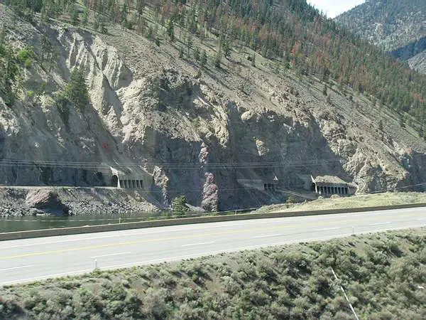
West Portal of the Connaught Tunnel, in the early 80s.
The 5-mile long Connaught Tunnel was built in 1914 after an avalanche killed 58 men who had been clearing a previous avalanche. The tunnel opened in 1916. A large squirrel fan driven by a diesel engine clears the fumes by forced air through a false ceiling inside the tunnel. The Connaught tunnel was originally double-tracked but in 1959, the track was laid down the middle instead and remains to this day. More recently, additional work was done to lower and upgrade the track to accommodate double stack trains and heavier rolling stock. The tunnel is in heavy use 24/7/365, with an average train being about a mile long. Originally, the Connaught tunnel created a bottleneck as pusher locomotives had to be used to ease westbound trains up the 2.2% grade at the East Portal (shown on this page) and they returned light to ROGERS. To solve the problem, CPR built the Mount Macdonald tunnel 360 feet (about 90 m) under the Connaught tunnel, reducing the grade considerably Eastbound trains now use the Connaught Tunnel, while westbound trains use the Mount Macdonald Tunnel, both considered to be the mainline. The tracks from both tunnels then rejoin a few miles beyond both exits. Our train (The Canadian) is eastbound about 1980. |
|
| This picture was taken and submitted by Massey F. Jones | ||
 |
One of a series of CPR snowsheds in Rogers Pass, along
the Illecillewaet River, composed of glacial meltwater. They were built to avoid a series of loops, in which several people became buried during in an avalanche around 1910. Several avalanches still occur yearly in Rogers Pass. The average snowfall in the area between 1981 and 2010 has been 340.4 inches (864.7 cm) or about 28 ft. (8.5 metres) for 112 days The eastbound view shown here is on a low point on the
|
|
| Video capture: Massey Jones | ||
 |
Another view, as the eastbound Rocky Mountaineer enters
yet another snowshed within Albert Canyon in the Selkirk Mountains in British Columbia. The grade at this point is one of the steepest stretches eastbound on the CPR Mountain Sub., between Revelstoke and Ross Peak. High to the left, and opened to vehicular traffic in 1962,
The name "Albert" comes not from Prince Albert, as was common for
naming places after royalty in the 1880s, but
|
|
| This picture was taken and submitted by Massey F. Jones | ||
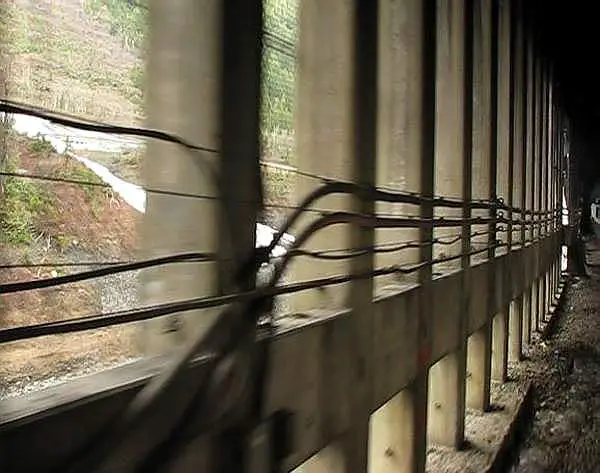 |
A view, passing through one of the Albert Canyon
snowsheds, from the platform of an eastbound Rocky Mountaineer train, May 2009. Coming out of this gallery, the train continues into a short tunnel. The Trans-Canada Highway can barely be seen through the mesh, on the left, close to the top. The mesh is necessary to keep out flying species. Electrical wiring runs along the pillars. |
|
| This picture was taken and submitted by Massey F. Jones | ||
 |
The west portal of Mount Macdonald tunnel from
the Trans-Canada Highway around 1985. In this view, the track is not yet entering the tunnel and can be seen on the right. This is a blowup of a section of the original (undated) Ektachrome slide. At 14.7 km, the Mount Macdonald tunnel is the longest railway tunnel in the Americas and it reduces the steep grade through Rogers Pass. http://en.wikipedia.org/wiki/Mount_Macdonald_Tunnel View the completed work at:http://marty1976.files.wordpress.com/2010/05/
|
|
| This picture was taken and submitted by Massey F. Jones | ||
 |
The Detroit River or CASO tunnel south portal shot from
College Avenue, Windsor ON. The north portal is in Detroit at the Michigan Central train depot. CASO, which stands for Canada Southern Railway is a "paper company" that does not own any rolling stock but is a combination of a group of companies. http://en.wikipedia.org/wiki/Canada_Southern_Railway The CASO tunnel opened in 1910. Until 1985, the tunnel was owned
by the Michigan Central Railroad and its successors, including Conrail.
Conrail sold the tunnel and connecting
The diesel unit running on the bridge is Essex Terminal
A CP train exiting the tunnel is at: http://www.youtube.com/watch?v=WCdsNefVuaI
|
|
| This picture was taken and submitted by Massey F. Jones | ||
 |
Approaching the Kitselas Canyon Tunnel
Kitseals Canyon is about 15 min.east of Terrace, BC |
|
| This picture was taken and submitted by Corey Walker, Prince George, BC | ||
.jpg) |
Approaching the Kitselas Canyon Tunnel | |
| This picture was taken and submitted by Corey Walker, Prince George, BC | ||
 |
Heading into the Bulkley Canyon Tunnel
Bulkley Canyon is located between New Hazelton and Smithers.
|
|
| This picture was taken and submitted by Corey Walker, Prince George, BC | ||
 |
Entering the Bulkley Canyon Tunnel | |
| This picture was taken and submitted by Corey Walker, Prince George, BC | ||
 |
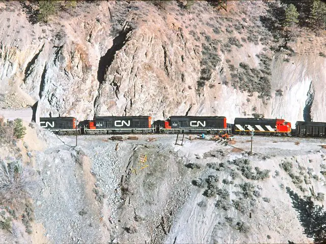
CN Railway Tunnel in Fraser Canyon
This photo was taken between Lytton and Spences Bridge |
|
| This picture was taken and submitted by Corey Walker, Prince George, BC | ||
 |
As the Canadian National Railway's mainline follows the Thompson
River from Kamloops to Lytton (about 100 miles),
it passes through 11 tunnels. These are the Skoonka Tunnels (roughly Milepost 80.0 Ashcroft Sub) near Spences Bridge BC, at GPS coordinates 50°21'27"N 121°23'49"W. This view is taken in May 2009 from the Rocky Mountaineer train. At this point, CN and CP run parallel to one another (and sometimes use another's track). In between the two railways are the Trans-Canada Highway and the Thompson River. This portion of the Trans- Canada is now mostly only used locally, since the Coquihalla Highway provides a better route to Vancouver, which explains the lack of road traffic. |
|
| This picture was taken and submitted by Massey F. Jones | ||
 |
A long CN train inches its way eastward through the Skoonka tunnels
along the Thompson Canyon in this view taken from
the Trans-Canada Highway on October 21st, 1988. The region is extremely arid, in mid-July with temperatures usually in the upper 30C (90F) range and very little rain. |
|
| This picture was taken and submitted by Massey F. Jones | ||
 |
Corey took another trip to on December 17, 2012
and photographed these tunnels in the Bulkley Canyon between Smithers and New Hazelton, BC on Via Rail's Jasper-Prince Rupert line. The train was headin westbound to Prince Rupert |
|
| This picture was taken and submitted by Corey Walker, Prince George, BC | ||
 |
Bulkley Canyon between Smithers and New Hazelton, BC | |
| This picture was taken and submitted by Corey Walker, Prince George, BC | ||
 |
Bulkley Canyon between Smithers and New Hazelton, BC | |
| This picture was taken and submitted by Corey Walker, Prince George, BC | ||
.jpg) |
BENGAL at Mile 1.1 CP Red Deer Sub in the
foreground, August 1989. Newsprint is brought to the brown Calgary Herald building to the right by the track through the culvert under Deerfoot Trail (Alberta Highway #2) |
|
| This picture was taken and submitted by Massey F. Jones | ||
 |
Meridian Yard lead that runs through tunnel under
Deerfoot Trail to service industries including the Calgary Herald, with grades of over 2.2% the steepest in the terminal, and classed as Mountain Grade. |
|
| This picture was taken and submitted by Larry Buchan | ||
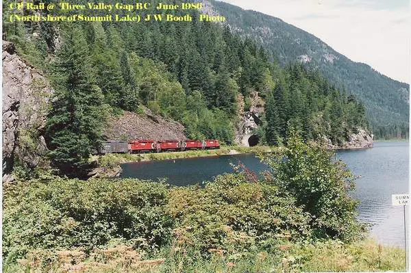 |
Three Valley Gap Tunnel, June 1986 | |
| This picture was taken and submitted by Jim Booth, Willingdon AB | ||
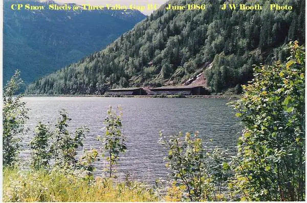 |
CP Snow sheds at Three Valley Gap BC, June 1986 | |
| This picture was taken and submitted by Jim Booth, Willingdon AB | ||
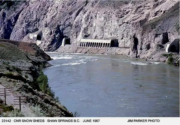 |
CNR Snow Sheds at Shaw Springs B.C. June 1967 | |
| This picture was taken and submitted by Jim Parker | ||
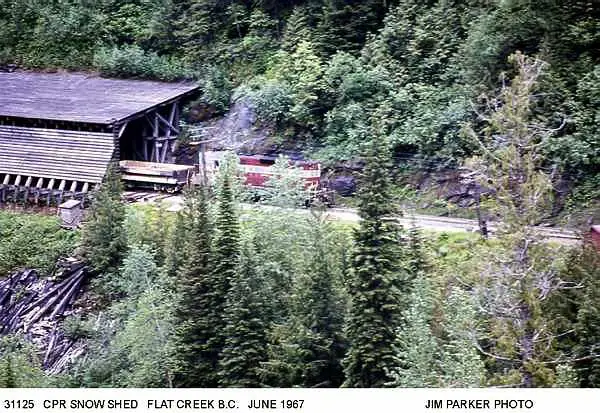 |
CPR Snow Shed at Flat Creek B.C. June 1967 | |
| This picture was taken and submitted by Jim Parker | ||
 |
The Rocky Mountaineer has just exited the last of the two snow/rock
sheds, eastbound along Three Valley Gap on May 11th, 2009. They are designed
to keep the area's abundant snow off the tracks, also to prevent falling
rocks from
blocking the rail. |
|
| This picture was taken and submitted by Massey F. Jones | ||
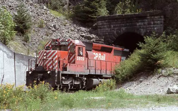 |
Extra West 5809 (notice the white flags and white
class lights) in 1970s CPR cab stripes, exiting the south side of CPR Tunnel No2 in the Fraser Canyon just north of Yale, BC, on way to Vancouver. The date over the tunnel opening reads '1905', which is most probably the year at which the stone was laid, The train is bound for the Vancouver area and about to enter Yale Tunnel No 1, just to the left of the photo. It was blasted from solid rock by Chinese navvies, back in 1885, as part of the Onderdonk contract with the CPR. Unlike Tunnel No 2, Tunnel No 1 doesn't have any stone work at the exit. Both tunnels have seen daily use, since their construction. The Yale tunnels continues to be in full operation today butthe SD40-2s have now been replaced by newer units. Today, SD40-2s continue their life, as yard switchers in large facilities. Others in Western Canada, are used mostly on branch lines or as extra units within consists. Above the rail tunnel is the old Trans Canada Highway portion, since replaced by the Coquihalla Highway, which avoids many road tunnels in the Fraser Canyon. |
|
| This picture was taken and submitted by Massey F. Jones | ||
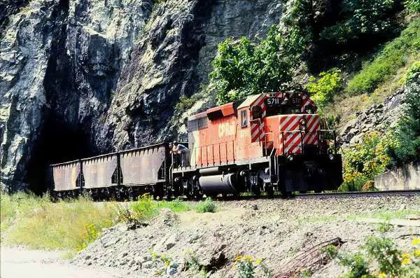 |
CP 5711 eastbound with a coal train through the
Tunnel No.1, in the Fraser Canyon at Yale BC, sometime in the late 70s. The historical tunnel, was carved through the rock around 1880 during the CPR was pushing West Along with the No.2 shown on this page, it is one of the original CPR tunnels in British Columbia. |
|
| This picture was taken and submitted by Massey F. Jones | ||
.JPG) |
The eastbound Rocky Mountaineer is about to enter the
CP Cantilever Bar Tunnel through Cisco Bluff on May 10th, 2009. It will then emerge on the other side of the Fraser River after crossing the gorge on a 3-span, 160 metres (520 ft)-long truss bridge, seen in photos such as http://www.flickr.com/photos/loose_grip_99/6175236749/ and proceed under the orange-painted CN cantilever bridge just upstream. The CPR was first through the area in 1885, and navvies blasted the
tunnel through solid rock, sometimes at great
When the current bridge was built at Cisco in 1910, the
Read more at: http://en.wikipedia.org/wiki/Cisco_Bridges
|
|
| This picture was taken and submitted by Massey F. Jones | ||
.jpg) |
The sign announces CISCO, about 6 miles south of
Lytton BC and 120 northeast of Vancouver in the Fraser Canyon on the CPR. The proper name is "Siska", home to the Siska First Nation, which has been in the area for thousands of years. In the stretch of the Fraser Canyon, CN and CP have
|
|
| This picture was taken and submitted by Massey F. Jones | ||
 |
It looks like a model railroad but this is the real thing.
SD-40 locomotives CN 5078, 5161 and F-7
5161 was rebuilt into the Alstom GCFX 6030-6079 for
|
|
| This picture was taken and submitted by Massey F. Jones | ||
.jpg) |
The attraction is the CN tunnel in the background,
at Hell's Gate BC, so named because the Fraser River narrows to a mere a passage only 35 metres (115 ft.) wide at that point. Prior to the railways arrival, Hell's Gate was an active aboriginal fishing area, located about 130 miles from Vancouver, just south of Boston Bar (for CN) or North Bend, almost across the river, for CP. Both are divisional points for their railway. http://en.wikipedia.org/wiki/Hells_Gate _(British_Columbia) In the 1880s the CPR built a transcontinental track
This view was taken from the Rocky Mountaineer
|
|
| This picture was taken and submitted by Massey F. Jones | ||
 |
This photo, taken from the Trans Canada Highway some
300 ft above, shows a 6300 series FP unit leading the VIA #2 Canadian through one of the Kicking Horse Canyon tunnels, just east of Golden BC (about 160 miles west of Calgary) in the late 1980s. The water on the left is the Kicking Horse River,
At this stage, the VIA 6300s, remanufactured from older
In order to take advantage of the former tourist trade on
The Kicking Horse River tunnels continue to be used
|
|
| This picture was taken and submitted by Massey F. Jones | ||
 |
One of the CPR tunnels near Golden BC, blasted through
the rock in the mid 1880s. A lot of this type of tunnel is not concrete-lined as many others. The river on the left is the Kicking Horse River, whose source is quoted by Wiki as being Wapta Lake, on top of the hill from the Spiral Tunnels, hence the green water from glacial melt . http://en.wikipedia.org/wiki/Kicking_Horse_River |
|
| This picture was taken and submitted by Massey F. Jones | ||
 |
In this photo, we have just passed through another
sandstone tunnel, near Golden BC. Note the slanted rock formation and well-maintained CPR roadbed. Even though the location is situated on the Toronto-Vancouver mainline, it's simply too expensive to double-track at this location. |
|
| This picture was taken and submitted by Massey F. Jones | ||
 |
Eastbound, after one of the 3 or 4 tunnels in Eagle Pass,
about 20km west of Revelstoke BC on a rainy May 11th, 2009. The area was the last one section to be completed, as CPR crews from the east met crews building from the west at nearby Craigellachie in 1885 and the Last Spike was driven, uniting Montreal with Port Moody (Vancouver). |
|
| This picture was taken and submitted by Massey F. Jones | ||
 |
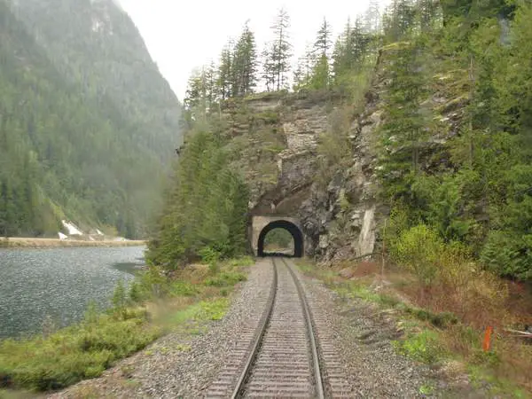
This scanned slide from my collection, shows a
northbound Pacific Great Eastern train at Horseshoe Bay in West Vancouver before 1974, when a one and one half mile tunnel was drilled under the nearby cliff, to allow for highway and ferry terminal improvement. A tunnel had been talked about for some time and apparently in 1972, a boxcar derailed and wrecked a house below. Above the train to the left, is the original "Sea to Sky" highway, from Vancouver to Squamish. |
|
| This picture was taken and submitted by Massey F. Jones | ||
 |
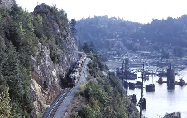
Sometime in March or April 1974, Massey visited the
site of where the BCR used to run along Horseshoe Bay on the way to Prince George with a railfan friend and he showed him what was left of the former roadbed. Unfortunately, there is no reference point in the picture, which is a scan from a colour negative. |
|
| This picture was taken and submitted by Massey F. Jones | ||
Click on this image for a larger view in a new window |
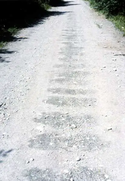
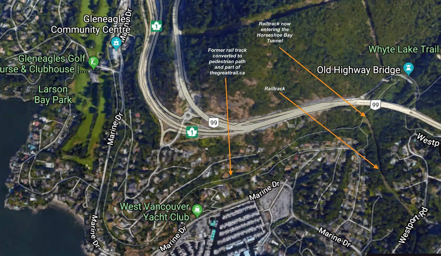
In relation to the picture posted above on the old West Vancouver
roadbed much of that railbed was converted to a trail that is part of the
TransCanada Trail. It shows a
straight portion which would be in the part of thegreattrail.ca |
|
| This picture was taken and submitted by Jonn Martell | ||
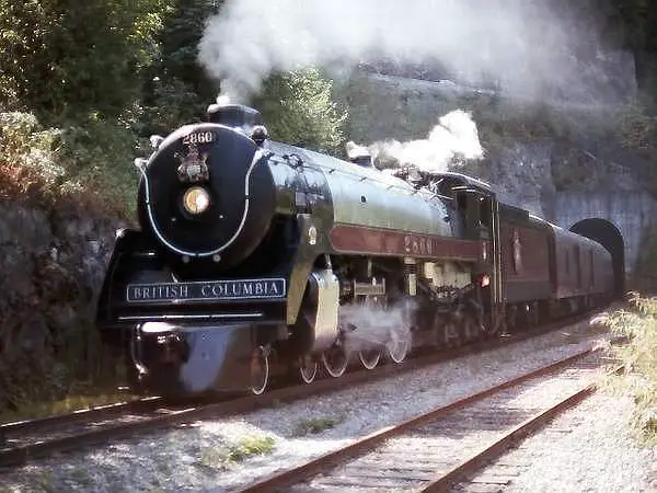 |
CPR2860 Exiting the Horseshoe Bay Tunnel.
The tunnel
was completed by BC Rail in August 1973. With a length of 4,568 feet, it was the longest tunnel on BC Rail until the Tumbler Ridge line opened during 1983. 2860 is now an operating museum piece in Squamish
B.C
|
|
| This picture was taken and submitted by Massey F. Jones | ||
 |
A very short culvert tunnel under University Drive in Lethbridge,
Alberta, about 0.9 mile (1,44 km) west of
the iconic "CPR High Level" railway bridge. This small tunnel is still an important railway access into the city and its large grain elevator. The trackside notation on the post reads: 111. The photo was taken April 13th, 2014 |
|
| This picture was taken and submitted by Massey F. Jones | ||
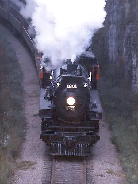 |
CPR 1201 coming out of the tunnel under
Dows Lake Ottawa ON |
|
| This picture was taken and submitted by Massey F. Jones | ||
 |
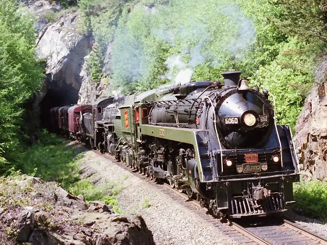
CNR 6060 blasting out of a tunnel at Milepost 32 BCR Squamish Sub
The line now owned by CN features a series
of tunnels. This one is almost opposite the Britannia Mine Museum, 32 miles from North Vancouver on the Sea to Sky Highwa (BC 99), half way between Vancouver and Whistler.. http://britanniaminemuseum.ca/ "Bullet Nose Betty 6060" was in Vancouver in 1986 to participate
in Steam Expo, which featured about 20
http://www.flickr.com/photos/carphotosbyrichard/sets/
As the BCR 2860 Royal Hudson came up for maintenance
|
|
| This picture was taken and submitted by Massey F. Jones | ||
 |
Exiting the south side of the tunnel pictured above,
"Bullet Nose Betty" ex-CN 6060 and ex-CPR Consolidation BCR 2816 are coasting southbound, about a mile north of Britannia Beach during the summer of 1988; on the return trip from Squamish. Shortly after this photo was taken, the 6060
Today, the 3716 operates on the
|
|
| This picture was taken and submitted by Massey F. Jones | ||
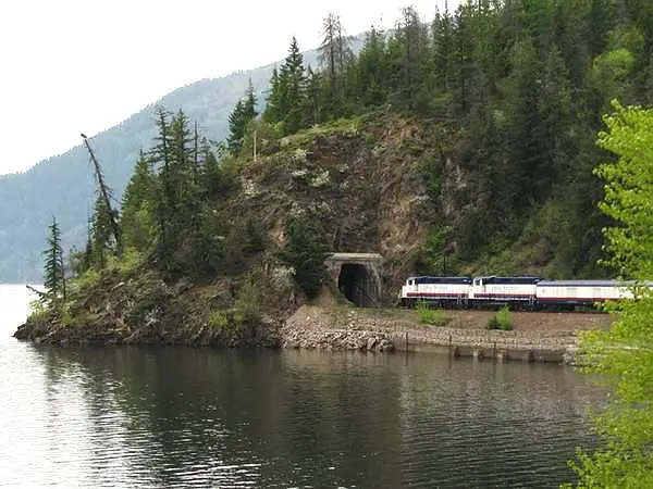 |
The Rocky
Mountaineer train about to enter one of the
many tunnels along the shore of Kamloops Lake in British Columbia, on May 10, 2009 |
|
| This picture was taken and submitted by Massey F. Jones | ||
|
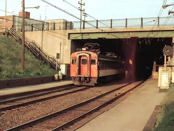
Electric motor 6733 exiting the tunnel into a trench at
PORTAL HEIGHTS along the Deux Montagnes line. The stop was formerly named CANORA after the Canadian Northern Railway, the ancestor of CN. One of 6 m.u. motors built in 1952, pulling 88-seat trailers in commuter service, CN 6733 operated with other electrics through the Mount Royal Tunnel from a platform at Gare Centrale/Central Station in downtown Montreal, well into the 70s . http://raakone.hubpages.com/hub/The-Deux- Montagnes-Line-and-the-Mount-Royal-Tunnel Deux Montagnes (French for Two Mountains), is a bedroom community in the Montreal area. Constructed in 1914, the tunnel became necessary to prevent CN trains
from going a log way around the Island of Montreal, as was the case with
their competitors,
http://en.wikipedia.org/wiki/Mount_Royal_Tunnel VIA Rail trains to/from Northern Quebec and the northern
You can see the interior of Gare Centrale at:
Today (after changing the electrical system from 2400V DC
Also shown is Electric motor 6732 |
|
| This pictures were taken and submitted by Massey F. Jones | ||
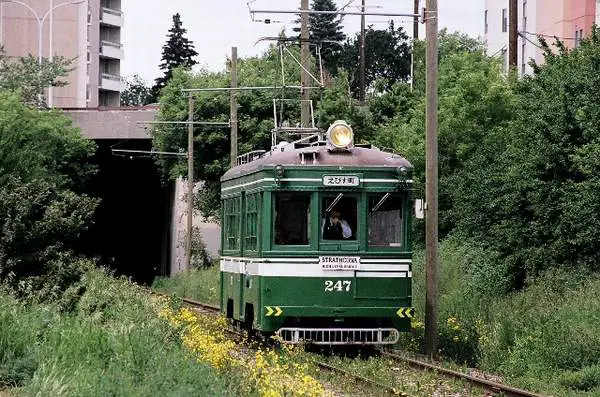 |
This tunnel passes under some apartments in
South
Edmonton on the old CPR right of Way, now called "The Ribbon of Steel" designated by Alberta Infrastructure and the City of Edmonton for the preservation of streetcar rail in Edmonton. The corridor formerly linked the South Edmonton
|
|
| This picture was taken and submitted by Massey F. Jones | ||
|
CPR Dunsmuir Tunnel Western outlet at Cordova/
Waterfront, circa 1934. This photo is part of a historical description at http://www.miss604.com/2010/07/tunnels-under- downtown-vancouver-history-readers-choice.html see also http://www.vancouverhistory.ca/archives_skytrain _tunnel.htm City of Vancouver Archives CVA 152-6.11.1 West Portal of the Dunsmuir Tunnel in downtown
Construction began in 1931 and was completed in 1933
Roughly a mile-long S curve (4579 feet/1396 metres), the
The second photo was taken in 1976, after the track had
http://en.wikipedia.org/wiki/Waterfront_
|
|
| This picture was taken and submitted by Massey F. Jones | ||
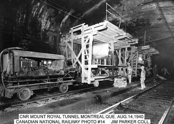 |
CNR Mount Royal Tunnel, Montreal Que. Aug 1940 | |
| This picture is part of the Jim Parker Collection |
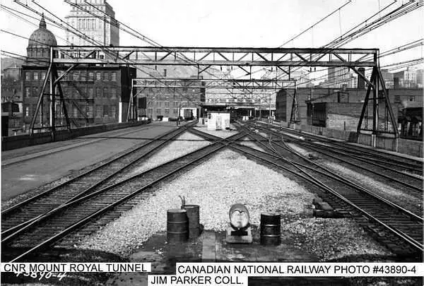 |
CNR Mount Royal Tunnel, Montreal Que |
| This picture is part of the Jim Parker Collection | |
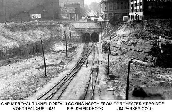 |
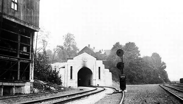
CNR Mount Royal Tunnel Portal, looking north from
Dorchester St. Bridge, Montreal Que 1931 |
| Jim Parker Collection | |
 |
The north end of CN Portal Heights (now AMT Canora),
showing the entrance to the Mount Royal tunnel into Gare Centrale/Central Station sometime in the mid-70s, with a CP train riding on its own track on top of the tunnel, west from the now abandoned Outremont Yard to their Cote St-Luc Yard for furtherance to other points. Outremont Yard: http://www.flickr.com/photos/ mtlwestrailfan/6903171546/ |
| This picture was taken and submitted by Massey F. Jones | |
 |
The Flett tunnel is located North West of Thunder Bay
Ontario, near Shabaqua. I believe it was originally a Grand Trunk Tunnel, then CNR. This line was abandoned in late 90s |
| This picture was taken and submitted by Tim Lukinuk,Thunder Bay, ON |
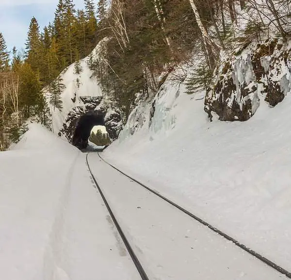
| After seeing all these tunnels from Canada except
the maritimes I
was send a small seried of pictures from Northern New Brunswick, the Morrissey Rock Tunnel submitted by Adele Beaton |
 |
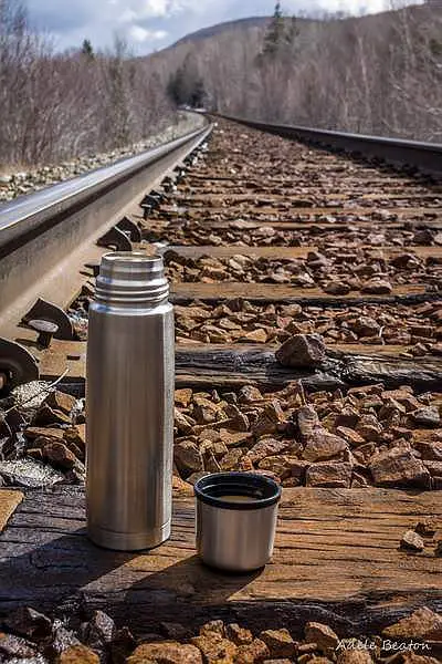
These first pictures are some track
shots on the way to thre tunnel |
 |
|
 |
|
 |
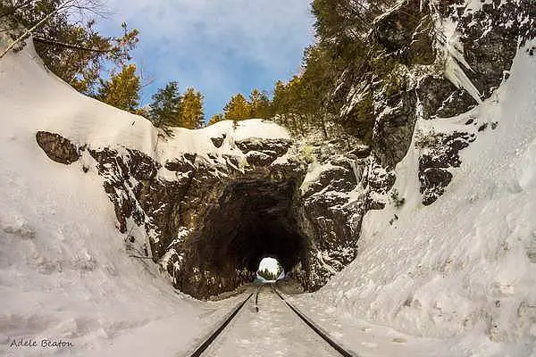
The Morrissey Rock Tunnel |
 |
The Morrissey Rock Tunnel |
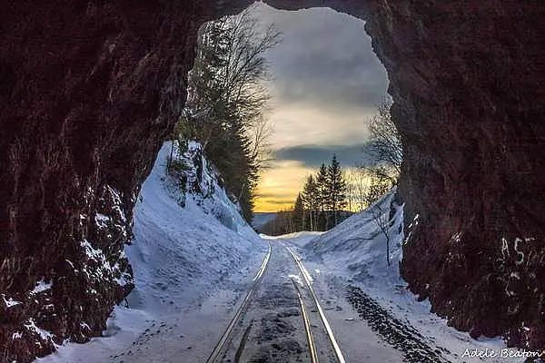 |
The Morrissey Rock Tunnel
Sorry folks but that's the best I
|
| Privacy Policy for http://yourrailwaypictures.com/
If you require any more information or have any questions about our privacy policy, please feel free to contact us by us by email at john@summervillens.ca At http://yourrailwaypictures.com/, the privacy of our visitors is of extreme importance to us. This privacy policy document outlines the types of personal information is received and collected by http://yourrailwaypictures.com/ and how it is used. Log Files
Cookies and Web Beacons
DoubleClick DART Cookie
Some of our advertising partners may use cookies and web beacons on
our site. Our advertising partners include ....
These third-party ad servers or ad networks use technology to the advertisements and links that appear on http://yourrailwaypictures.com/ send directly to your browsers. They automatically receive your IP address when this occurs. Other technologies ( such as cookies, JavaScript, or Web Beacons ) may also be used by the third-party ad networks to measure the effectiveness of their advertisements and / or to personalize the advertising content that you see. http://yourrailwaypictures.com/ has no access to or control over these cookies that are used by third-party advertisers. You should consult the respective privacy policies of these third-party ad servers for more detailed information on their practices as well as for instructions about how to opt-out of certain practices. http://yourrailwaypictures.com/'s privacy policy does not apply to, and we cannot control the activities of, such other advertisers or web sites. If you wish to disable cookies, you may do so through your individual browser options. More detailed information about cookie management with specific web browsers can be found at the browsers' respective websites. |