 |
 |
 |
|
|
|
|
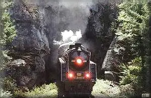
Canadian Train Bridges and Trestles
British Columbia and the Territories
| I decided to write this page on railway bridges after
a visitor Arthur Grieve, Winnipeg, Manitoba offered
to give me a number of railway bridge pictures that he had collected.
I again hope that my visitors will be sending me their pictures to be included on this page. johnmacdonald@summerville-novascotia.com |
|
|
|
|
|
|
|
|
 |
|
|
Join me on facebook
so that you can keep up with all the changes to
this page and all the rest that make up Old Canadian
Railways
 |
|
|
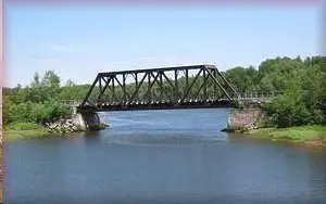
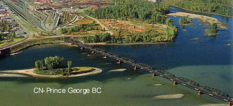
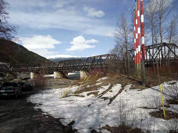
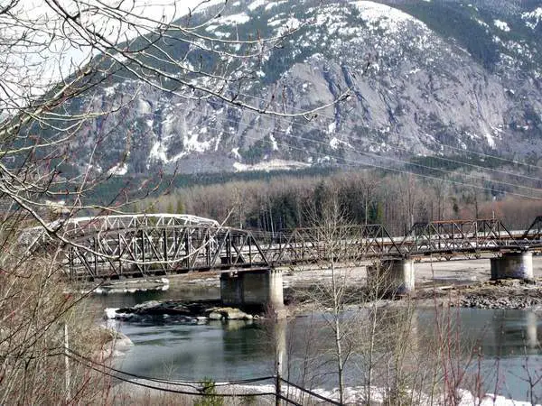
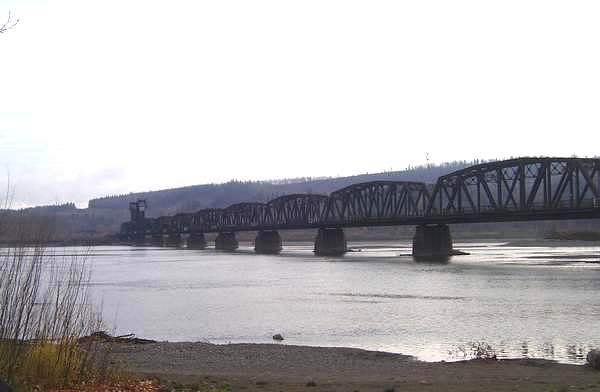
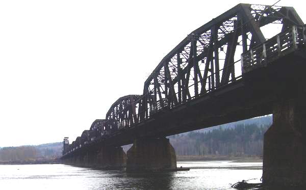
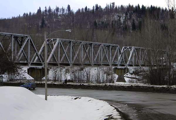
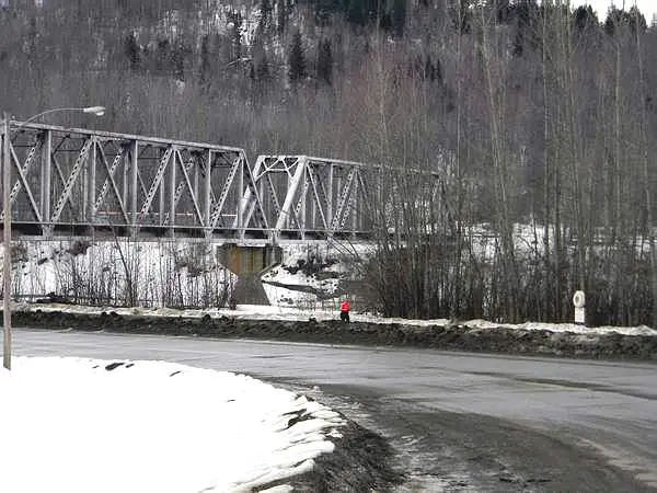
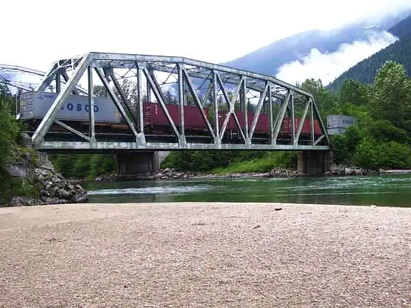
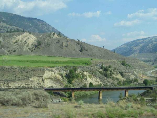
| CNR bridge spanning the Frazer River at Prince George BC. This railway
bridge was built by the Grand Trunk Pacific.
The river flowing into the Frazer at the upper right is the Nechako.This bridge was built by the Grand Trunk Pacific Rwy. c.1910 |
 |
|
|
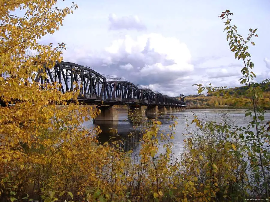
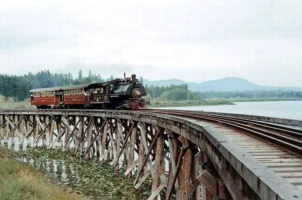
| This picture was submitted by Thomas Mills and is shown with other pictures in this area at http://whitesprucepress.com/gallery/displayimage.php?pid=30 This picture was taken in the fall of 2005 |
 |
|
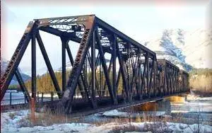
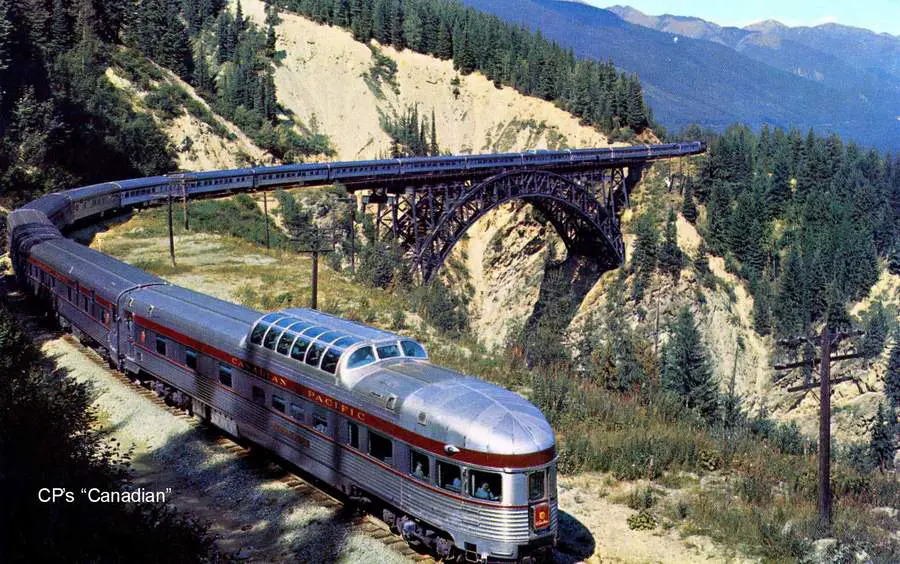
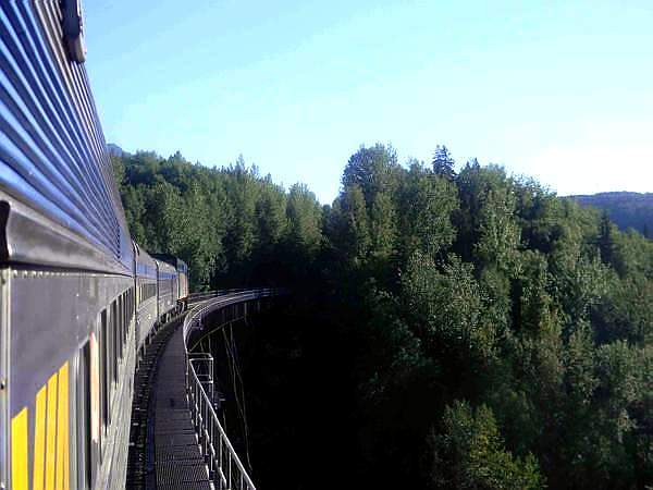
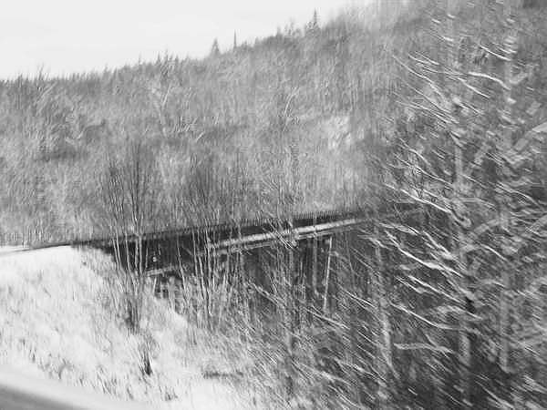
This bridge is at the top of the 10 mile 2.2 grade from Rogers and is 265 ft to the bottom |
| This description was provided by James Walford, retired CP locomotive engineer |
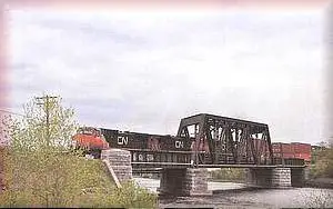
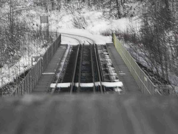
| This picture was submitted by Arthur Grieve, Winnipeg, Manitoba |
 |
|
|
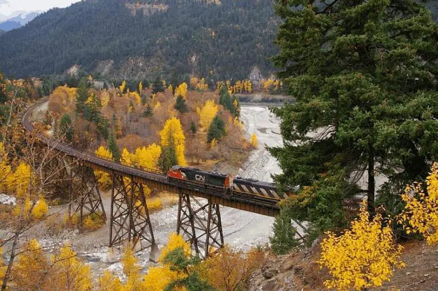
| This picture was taken by Peter Maslak and was submitted by Jean Guy Hamel, Quebec, Canada |
 |
|
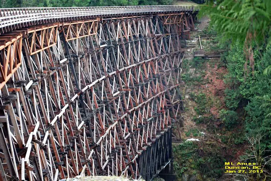
It is located just north of Shawnigan Lake on Vancouver Island |
| This picture was submitted by Dave Ames, Duncan BC and was taken by his wife Mary Ames |
|
|
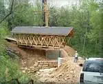
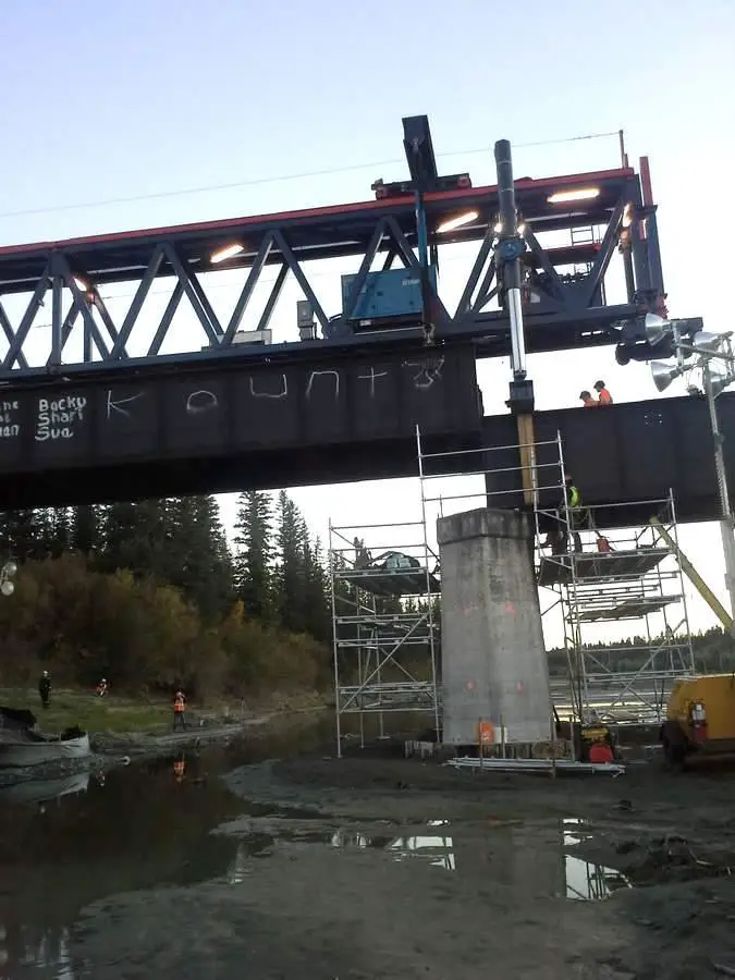
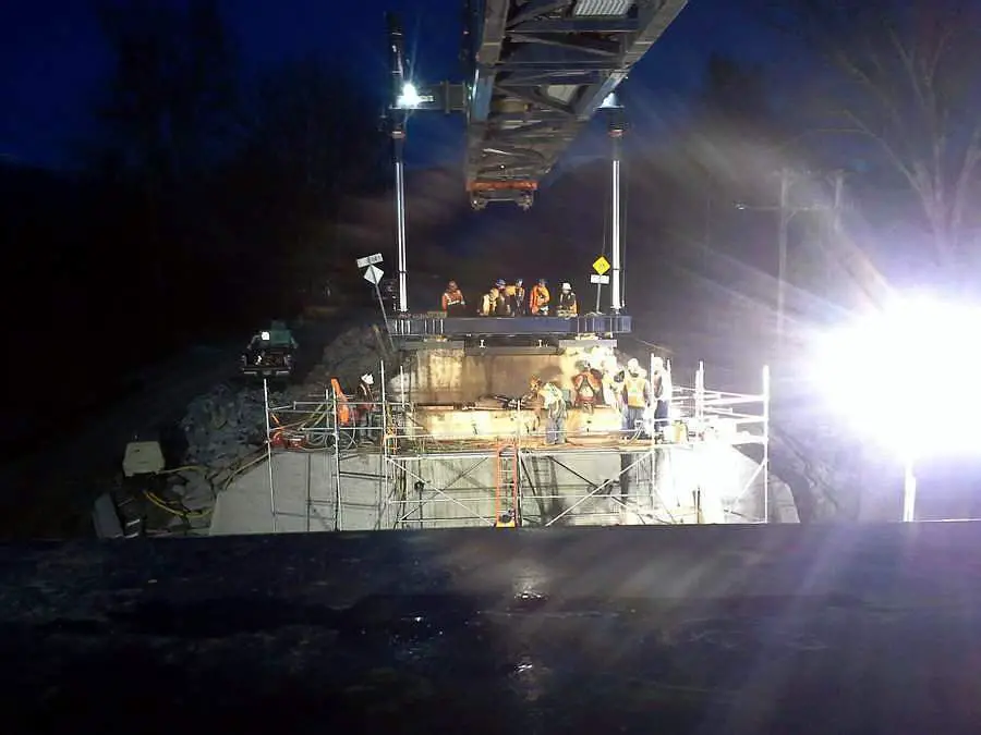
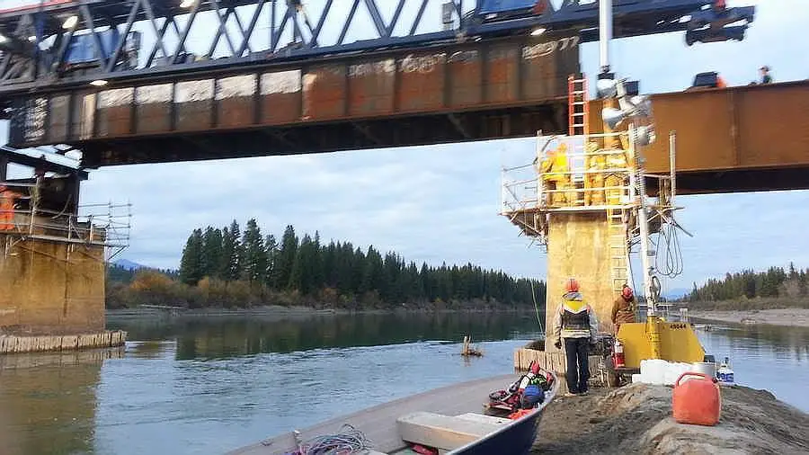
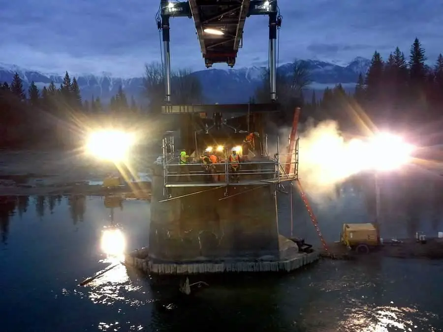
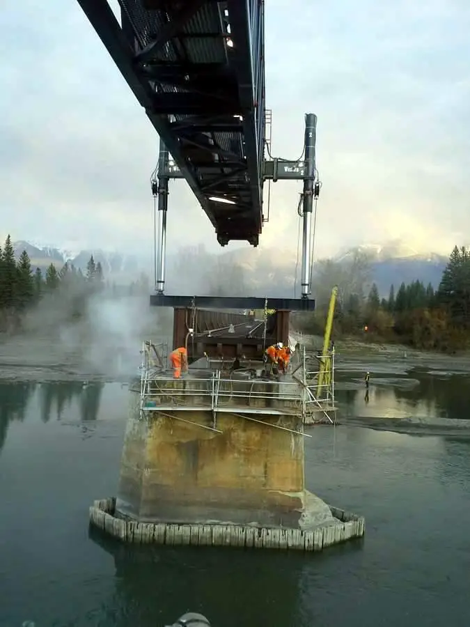
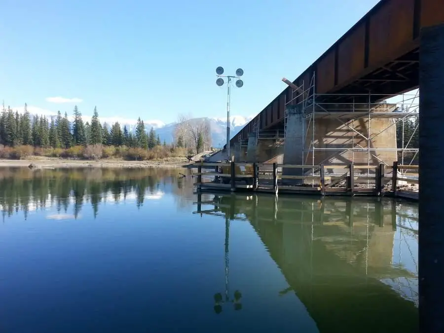
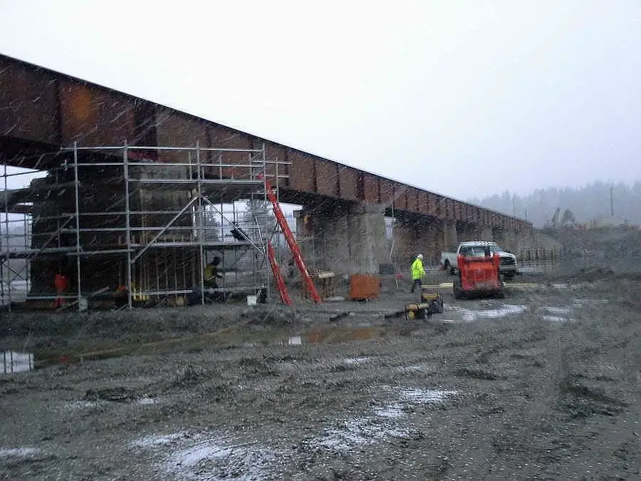
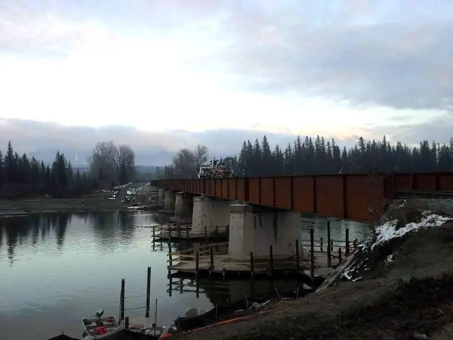
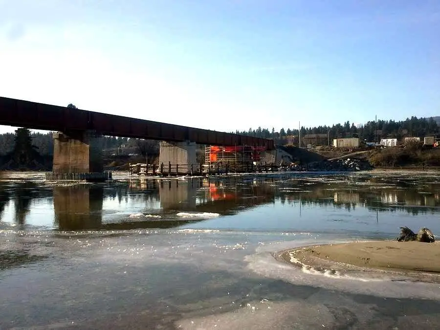
| This series shows around the clock work to remove
and replace 8 existing steel spans that had reached the end of their lifespan
with 8 new ones. Also to jacket all the piers and tie back the existing
abutments.
The project started in 2013 and completed in May 2014. The heavy lift was done in October 2013 Owner = CPR
|
| Pictures were submitted by Doug Webb |
 |
 |
 |
 |
 |
 |
 |
 |
 |
 |
 |
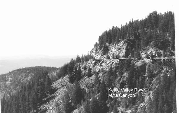 |
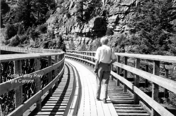
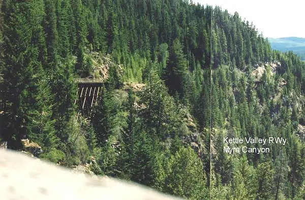
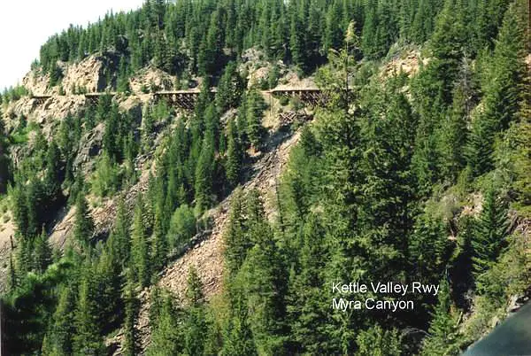
Kettle Valley Railway Bridge in Myra Canyon
The Kettle Valley Railway was built in it's entirety
The Coquillhalla Sub was abandoned in 1961. Even with the
In 1979, the Carmi Sub between Midway and Penticton was abandoned,
and thus, the old KVR was dead, except for the 160 miles between Spencer
Bridge and Penticton. This was abandoned in 1989, officially ending all
rail service on
Caption by"Jamie Masters" |
| This picture was submitted by Arthur Grieve, Winnipeg, Manitoba | |
 |
Kettle Valley Railway Bridge in Myra Canyon |
| This picture was submitted by Arthur Grieve, Winnipeg, Manitoba | |
 |
Kettle Valley Railway Bridge in Myra Canyon |
| This picture was submitted by Arthur Grieve, Winnipeg, Manitoba | |
 |
Kettle Valley Railway Bridge in Myra Canyon |
| This picture was submitted by Arthur Grieve, Winnipeg, Manitoba |
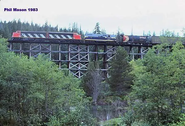 |
CN Wooden Train Trestle near Terrace, BC |
| This picture was taken by Phil Mason and was submitted by Jean Guy Hamel | |
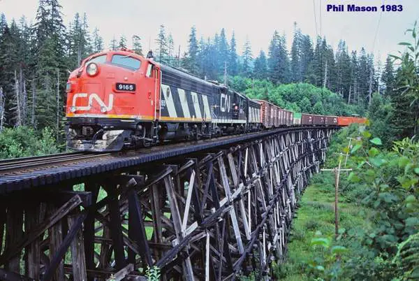 |
CN Railway Trestles on the Kitimat Branch |
| This picture was taken by Phil Mason and was submitted by Jean Guy Hamel | |
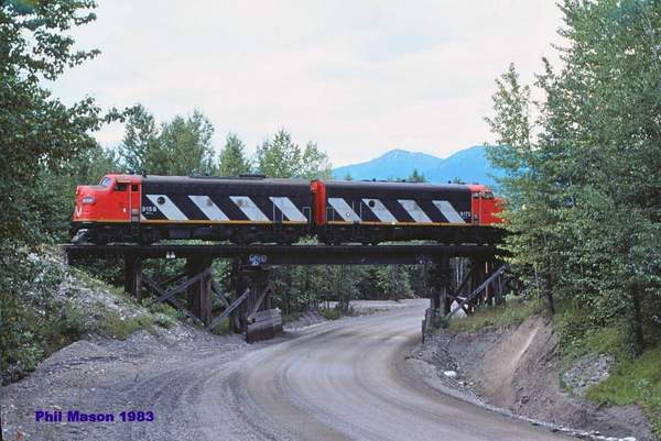 |
CN Wooden Overpass near Kitimat, BC. |
| This picture was taken by Phil Mason and was submitted by Jean Guy Hamel | |
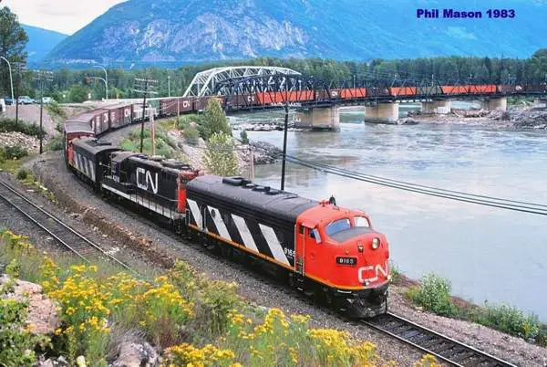 |
CN railway Bridge at Terrace, BC |
| This picture was taken by Phil Mason and was submitted by Jean Guy Hamel | |
 |
A typical railway truss bridge in a view taken from the
rear platform of the Rocky Mountaineer train in May 2009. The Kicking Horse River flows under this bridge, located near Golden BC. http://en.wikipedia.org/wiki/Truss_bridge http://en.wikipedia.org/wiki/Kicking_Horse_River |
| This picture was taken and submitted by Massey F. Jones | |
 |
Looking west on the rail bridge over the channel at
Sicamous BC (pronounced "sicamoose") from the rear of the Rocky Mountaineer train in May 2009. On right side, Shuswap Lake, on the left side Mara Lake. Sicamous is midway between Vancouver and Calgary, Alberta, on the Trans-Canada Highway and is known as "the houseboat capital of Canada". Hundreds are available for rental, due to large amounts of shoreline along each lake. http://en.wikipedia.org/wiki/Sicamous,_British_Columbia |
| This picture was taken and submitted by Massey F. Jones | |
 |
CN Kitimat Branch Line bridge over the Skeena River |
| This picture was taken Bill Walker and submitted by Corey Walker, Prince George, BC | |
 |
CN Kitimat Branch Line bridge over the Skeena River
The grey road bridge you see beside the rail bridge is
|
| This picture was taken Bill Walker and submitted by Corey Walker, Prince George, BC | |
.jpg) |
CN Kitimat Branch Line bridge over the Skeena River |
| This picture was taken Bill Walker and submitted by Corey Walker, Prince George, BC | |
 |
CN Kitimat Branch Line bridge over the Skeena River |
| This picture was taken Bill Walker and submitted by Corey Walker, Prince George, BC | |
.jpg) |
CN Kitimat Branch Line bridge over the Skeena River |
| This picture was taken Bill Walker and submitted by Corey Walker, Prince George, BC | |
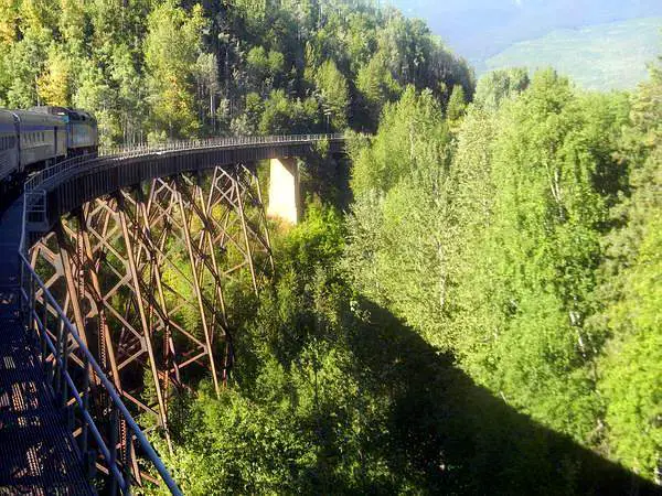 |
Porphyry Creek 001 This is a curved trestle bridge
over 40 metres high across Porphyry Creek near Moricetown, BC. The bridge is located at mile 31.3 in the Bulkley Subdivision on the CN Mainline and is an original bridge built somewhere between 1912 and 1913. The photograph was taken from a side door in the vestibule of the Park Car on the Skeena Passenger Train heading west to Prince Rupert on August 14, 2014. |
| This picture was taken and submitted by Corey Walker, Prince George, BC | |
.JPG) |
Porphyry Creek 002 Another shot, zoomed in slight
ly more of the historic, curved trestle bridge over Porphyry Creek at mile 31.3 in the Bulkley Subdivision on the CN Mainline. Taken from the Skeena Passenger Train heading west to Prince Rupert on August 14, 2014. |
| This picture was taken and submitted by Corey Walker, Prince George, BC | |
 |
the Seeley Gulch Bridge near New Hazelton, BC |
| This picture was taken and submitted by Corey Walker, Prince George, BC | |
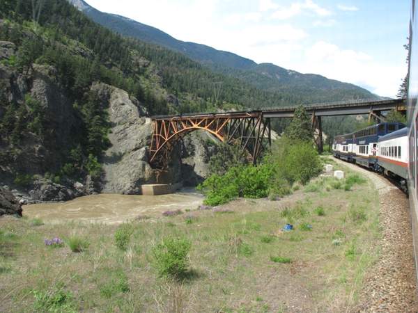 |
When the Canadian Pacific Railway built along the Fraser River in
the early-1800s, it chose the easiest route.
Later, its rival, the Canadian Northern Railway (later Canadian National Railway) also wanted to build but couldn�t squeeze two sets of rail lines on the same side of the Fraser Canyon and had to build on the other, but trickier side. Both crossed the Fraser River at Cisco (proper name: Siska),
about 9.5 miles south of Lytton BC on their own tracks. To do so, CN had
to build a girder bridge but
Eastbound on CP tracks now, our Rocky Mountaineer
There is a splendid photo of both bridges in several resolutions
at: http://en.wikipedia.org/wiki/File:Canadian_Pacific_
The Canadian National bridge is a truss arch bridge, 247 metres (810
ft) long and 90 metres (300 ft) high. The north-west end of the bridge
abuts into a near-vertical rock face. The south-east end of the bridge
crosses the CPR tracks about 100 metres (330 ft) north of the CPR bridge.
http://en.wikipedia.org/wiki/Cisco_Bridges
|
| This picture was taken and submitted by Massey F. Jones | |
.jpg) |
A view from almost directly under the CN girder
bridge taken at At this point on the trip, the Rocky Mountaineer slows down to about 15 mph, to allow passengers a full view of the scenery, another slowdown occurring on top of the Stoney Creek Bridge around Revelstoke and perhaps a few other notable sites, as time allows. |
| This picture was taken and submitted by Massey F. Jones | |
 |
The top deck of the Stoney Creek Bridge, straddling the Beaver Canyon;
in Glacier National Park, between Revelstoke and Golden BC
Its centre span is at the CPR Mile 76.2 Mountain Sub
This view is a from a video looking east from the rear platform of
the Rocky Mountaineer train in May 2009.
For a westbound video by someone else: http://www.youtube.com/watch?v=t0E9toG-TZ8.
It is
|
| Video capture: Massey F. Jones | |
.jpg) |
After crossing the CP Cantilever Bar Tunnel, passengers come upon
this view of the CN Truss Arch Bridge
and Fraser River canyon as they are about to cross the Cisco Bridge, barely seen in the lower right corner. While the Trans-Canada (#1 Highway) is about a
|
| This picture was taken and submitted by Massey F. Jones | |
_R.jpg) |
CPR 5821 leads an eastbound coal drag over the
Revelstoke railway bridge over the Columbia River in BC, summer 1975 |
| This picture was taken and submitted by Massey F. Jones | |
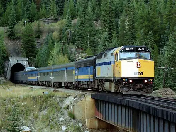 |
This steel bridge is situated at the exit of the lower
portal of the lower spiral tunnel. Above the tunnel portal is the upper track, barely seen through the trees VIA 6407 is leading "The Canadian" west over the bridge, which is the last step for trains within in the spiral tunnels complex. Unfortunately, VIA ceased to go through the area in January 1990 and was replaced that summer, by the Rocky Mountaineer; a private company operating luxury trains on a 2-day daulight-only trips. Photo taken in the late 1980s |
| This picture was taken and submitted by Massey F. Jones | |
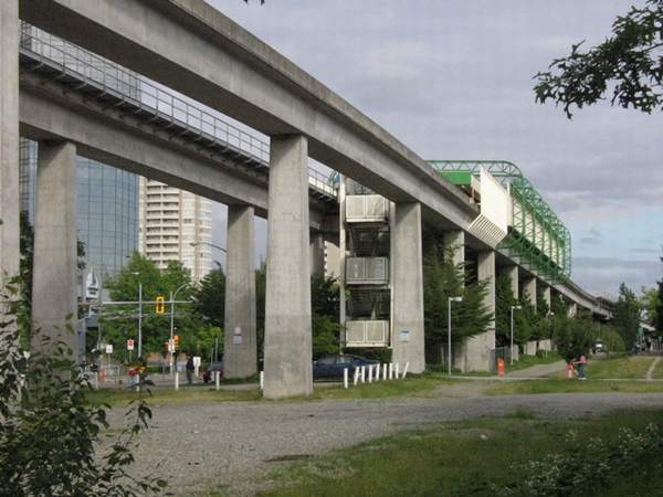 |
Although this isn't a "railway bridge" as such, this photo gives
an excellent idea of most Vancouver Skytrain guideways. Two tracks
are in the guideway and all
signalling is automatic. There is no operator on the trains. If something or someone falls on the tracks, all trains will stop automatically. This one is of the Metrotown Skytrain station in Burnaby, a Vancouver suburb, June 27th, 2007. |
| This picture was taken and submitted by Massey F. Jones | |
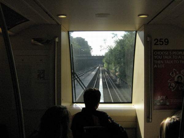 |
A view from inside the Vancouver Skytrain guideway.
The bridge above is a road. |
| This picture was taken and submitted by Massey F. Jones |
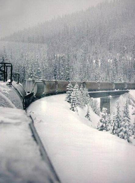 |
Some winter shots I took from the caboose of an
eastbound CPR freight in 1980, when I was set back working as an engine service brakeman this view shows the bridge over the Kicking Horse River near field British Columbia. |
| This picture was taken and submitted by Larry Buchan | |
 |
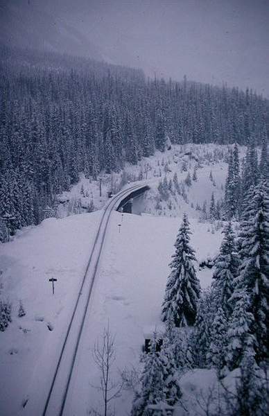
This picture shows our caboose on the bridge and the
lead units of our train emerging from Spiral Tunnel No.2 on Field Hill. |
| This picture was taken and submitted by Larry Buchan | |
 |
Looking westward at the bridge when our caboose had
emerged from the west portal of the Spiral Tunnel. |
| This picture was taken and submitted by Larry Buchan | |
 |
Mile 82.2 Laggan Subdivision small bridge approaching
Banff taken from the Canadian 1980 |
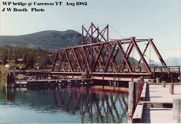 |
WP Bridge at Carcross YT, Aug 1982 |
| This picture was taken and submitted by James Booth, Willingdon AB |
 |
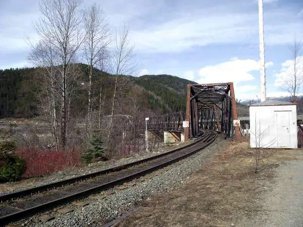
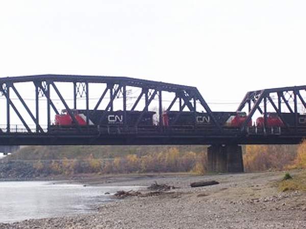
The Grand Truck Pacific Bridge in Prince George,
BC The bridge was built in 1914, a year before Prince George was first incorporated. |
| This picture was taken and submitted by Corey Walker, Prince George, BC | |
 |
The Grand Truck Pacific Bridge in Prince George, BC |
| This picture was taken and submitted by Corey Walker, Prince George, BC | |
 |
The Grand Truck Pacific Bridge in Prince George, BC |
| This picture was taken and submitted by Corey Walker, Prince George, BC | |
 |
The Grand Truck Pacific Bridge in Prince George, BC |
| This picture was taken and submitted by Corey Walker, Prince George, BC | |
 |
The Grand Truck Pacific Bridge in Prince George, BC |
| This picture was taken and submitted by Corey Walker, Prince George, BC | |
 |
The Grand Truck Pacific Bridge in Prince George, BC |
| This picture was taken and submitted by Corey Walker, Prince George, BC | |
 |
BC Rail (CN Lease) Quesnel River train bridge
There are two rail bridges over the Quesnel River, both in the city the river's named after. This bridge is both a bridge and an overpass across a stretch of road known as Johnson Loop. The bridge crosses the Quesnel River by its mouth with the Fraser River, BC's longest river entirely within BC. |
| This picture was taken and submitted by Corey Walker, Prince George, BC | |
 |
BC Rail (CN Lease) Quesnel River train bridge |
| This picture was taken and submitted by Corey Walker, Prince George, BC | |
 |
BC Rail (CN Lease) Quesnel River train bridge |
| This picture was taken and submitted by Corey Walker, Prince George, BC | |
 |
BC Rail (CN Lease) Quesnel River train bridge.
This is the second of the two bridges crossing this river at Quesnel, BC This bridge serves the sawmills and pulp mills of Quesnel |
| This picture was taken and submitted by Corey Walker, Prince George, BC | |
 |
CN Exchamsiks River Bridge
This bridge is at its mouth with the Skeena, the second longest river entirely within BC. The bridge is 50km west of Terrace and 90km east of Prince Rupert. |
| This picture was taken and submitted by Corey Walker, Prince George, BC | |
 |
CN Exchamsiks River Bridge |
| This picture was taken and submitted by Corey Walker, Prince George, BC | |
 |
CN Second Narrows Railway Bridge that goes across
Burrard Inlet showing The Ironworkers Memorial Second Narrows Crossing behind it. For more information on the narrows bridge go to this site. http://en.wikipedia.org/wiki/Second_Narrows_Bridge |
| This picture was taken and submitted by Corey Walker, Prince George, BC | |
 |
CN Second Narrows Railway Bridge
The Second Narrows Bridge is a vertical lift railway
|
| This picture was taken and submitted by Corey Walker, Prince George, BC | |
 |
CN Second Narrows Railway Bridge |
| This picture was taken and submitted by Corey Walker, Prince George, BC | |
 |
CNR Hansard Rail Bridge
This bridge crosses the Fraser River between Upper Fraser and Sinclair Mills. Upper Fraser was a company town that Northwood Pulp and Timber closed in July 1999. Sinclair Mills is a small community, but still in existence. Until a few years ago, the road crossed over the bridge, sharing the same space that the railway traciks occupied. Traffic lights on either end of the bridge were controlled by men who worked in a booth on the bridge. It is now a rail only bridge. |
| This picture was taken and submitted by Corey Walker, Prince George, BC | |
 |
CNR Hansard Rail Bridge |
| This picture was taken and submitted by Corey Walker, Prince George, BC | |
 |
This is a railway bridge over a creek in the
Fraser Canyon near Spences Bridge, visible from the Trans Canada Highway |
| This picture was taken and submitted by Corey Walker, Prince George, BC | |
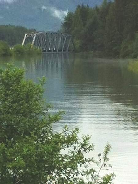
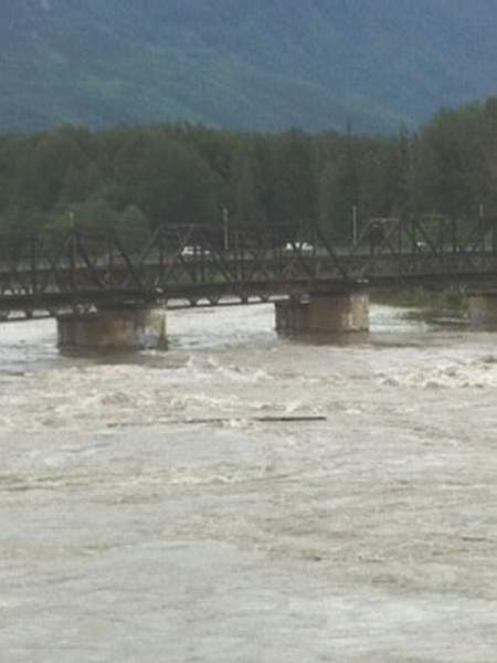
| The following series of four pictures shows the spring flooding
in the
Prince George, BC area. They were submitted by Corey Walker, Prince George, BC They were taken by his mother, Miriam Walker using an iPhone so the quality is not as high as I would like but they do show the river in flood.This is during the spring 2012 flood, which saw the Skeena and Kalum Rivers reach their highest levels since 1972. The photos were taken on June 25 |
|
 |
The bridge is on the CN mainline between Jasper and
Prince Rupert, over the Zymacord River in the community of New Remo. The Zymacord is a tributary of the Skeena River, and is located about 15 minutes west of Terrace, BC. The photo was taken on June 25, 2012 at the height of the spring 2012 flood, during which river levels were higher than they'd been since 1972. |
| This picture was submitted by Corey Walker, Prince George, BC | |
 |
CN Bridge over the Skeena River on the branch line to Kitimat, just west of the Terrace, BC CN Yards. |
| This picture was submitted by Corey Walker, Prince George, BC | |
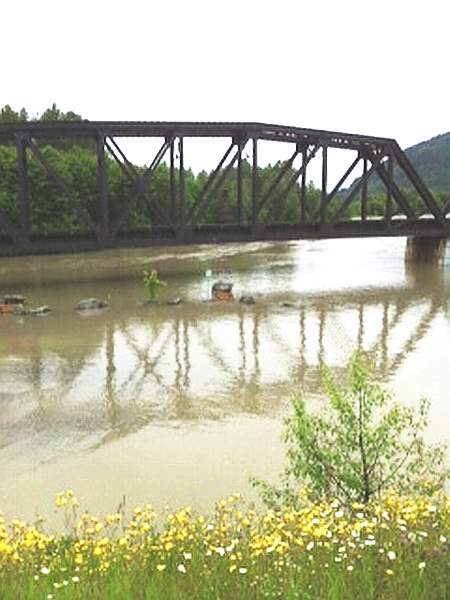 |
CN bridge over the Kalum River at its mouth with the Skeena River
on the mainline to Prince Rupert.
The Kalum River forms the western boundary of the City of Terrace and the eastern boundary of the Kitsumkalum First Nations Reserve, that the river takes it name from. This is during the spring 2012 flood, which saw the Skeena and Kalum Rivers reach their highest levels since 1972. The photo was taken on June 25 |
| This picture was submitted by Corey Walker, Prince George, BC | |
 |
CN train just west of Terrace heading to Prince Rupert
at the height of the spring 2012 flood, |
| This picture was submitted by Corey Walker, Prince George, BC |
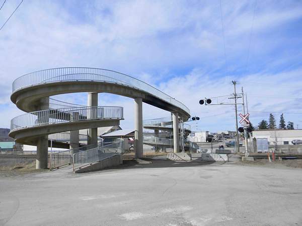 |
The BC Rail footbridges over railway tracks over the
tracks in Quesnel, quite close to the former BCR Station. The bridge is a concrete spiral beside what was once an active railway crossing. The crossing is only open now in the spring when Johnson Loop is flooded. When open, the crossing provides direct access to the Johnson Bridge across the Quesnel River into Johnson Subdivision (the subdivision where the caboose is located and found on the Caboose page). |
| This picture was taken and submitted by Corey Walker, Prince George, BC | |
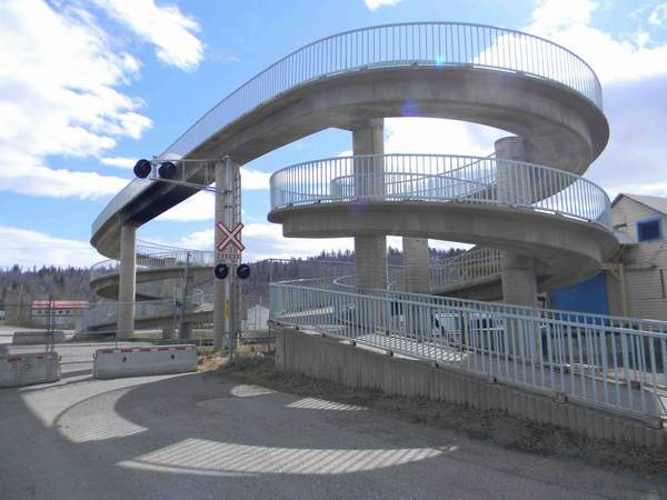 |
The BC Rail footbridges over railway tracks over the
tracks in Quesnel, |
| This picture was taken and submitted by Corey Walker, Prince George, BC | |
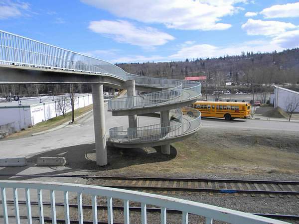 |
The BC Rail footbridges over railway tracks over the
tracks in Quesnel, |
| This picture was taken and submitted by Corey Walker, Prince George, BC | |
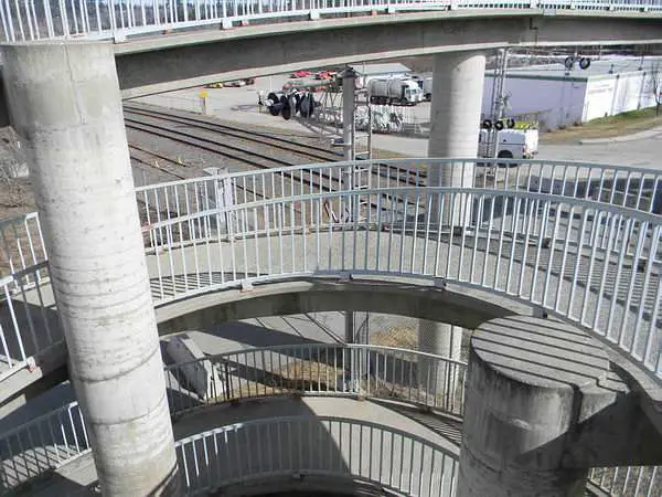 |
The BC Rail footbridges over railway tracks over the
tracks in Quesnel, |
| This picture was taken and submitted by Corey Walker, Prince George, BC | |
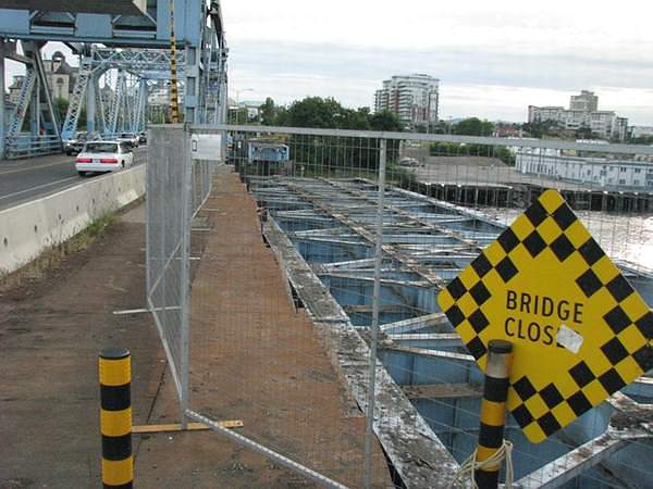 |
The remains of the rail bridge truss (span4) from the E&N station
end in June 2012, with the bridge on the left still handling traffic. Future
plans call for building a new bridge
by 2016; to the left of the old one, which will then be removed. It will be a bascule geared design and not fitted with rail. http://www.johnsonstreetbridge.com/the-project/design/ |
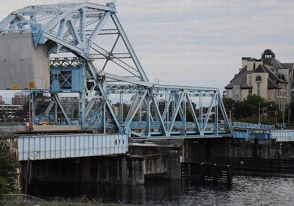 |
A three-quarter view of the Johnson Street Bridge in June 2012,
with the rail span now removed. The station was located on the left side
in the photo. On Friday, February 24 2011, the largest single-lift crane
barge in Western Canada lifted the rail portion of the 88 year old bridge
and its 500 (metric) tonne counterweight (about 551.3 US tons) its foundation,
lowered the load onto the barge and it was floated away to be scrapped
due to severe corrosion. http://www.vancouversun.com/news/thewest/Barge+arrival
+begins+Johnson+Street+Bridge/6191054/story.html. Anyone interested in a complete assessment of the Johnson Street Bridge for heritage value can visit: johnsonstreetbridge.org/pdf/kalmanreport.pdf The report contains several engineering and historical photographs. The large building in the background is the
|
| This picture was taken and submitted by Massey F. Jones | |
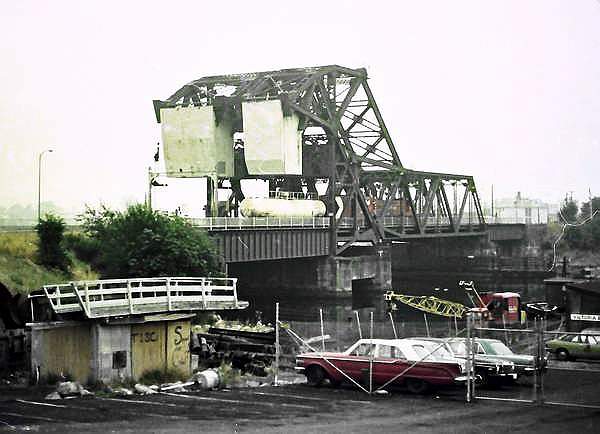 |
A scan from a colour negative taken by a friend, brought
out an early 1970s view of the Johnson Bridge with both spans in place and an E&N train running on the bridge, northbound out of Victoria City Centre. |
| This picture was submitted by Massey F. Jones and is part of
the Massey F. Jones Collection |
|
.jpg) |
A view from the eastbound Rocky Mountaineer;
showing part of the century-old New Westminster swing bridge in the foreground, spanning the south shore of the Fraser River at New Westminster and the north shore at Surrey BC. In the next few minutes, our train will turn left and ride on it. The New Westminster Bridge was constructed in 1904
It is owned and operated by the BNSF Railway, while
The Patullo Bridge in the background was named in
|
| This picture was taken and submitted by Massey F. Jones |
|
by James Booth, Willingdon AB |
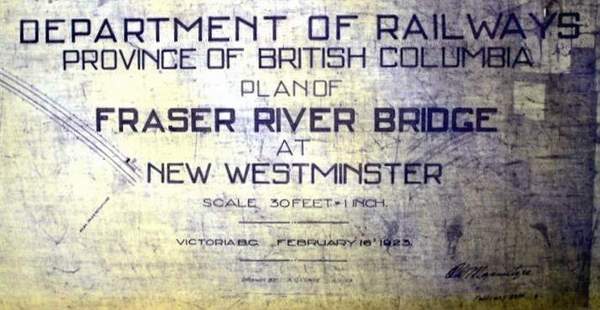 |
Dwg Title Block |
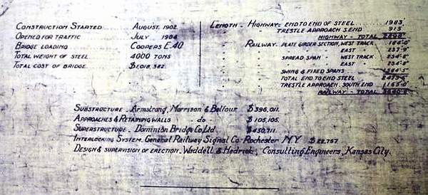 |
Bridge History |
.jpg) |
First Span South of the New Westminster BC Bridge |
.jpg) |
First Two Spans of the South Side of the Swing Span |
.jpg) |
2nd Span South of the New Westminster Bridge |
.jpg) |
Swing Span of the Bridge |
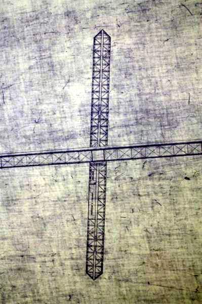 |
Swing Span of the Bridge (Plan View) |
.jpg) |
2nd Two Spans South of the Swing Span |
.jpg) |
Port Mann End of the Bridge |
 |
Port Mann End of the Bridge (Plan View) |
-a.jpg) |
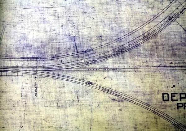
New Westminster end of bridge (plan view) |
_showing_station_location.jpg) |
New Westminster end of bridge
(plan view) showing station location This was a GN ( BNSF) station. It is long gone, as is the roadway
that was on the bridge.
|
 |
CP Roseberry Landing, Oct 1981 |
| This picture was taken and submitted by Jim Booth, Willingdon AB | |
 |
Skeena Crossing CN Bridge
Corey took these pictures from a moving train. The bridge is on the CN mainline to Prince Rupert, and the train was Via Rail's Skeena train, running from Jasper to Prince Rupert. |
| This picture was taken and submitted by Corey Walker, Prince George, BC | |
 |
Skeena Crossing CN Bridge |
| This picture was taken and submitted by Corey Walker, Prince George, BC | |
 |
Skeena Crossing CN Bridge |
| This picture was taken and submitted by Corey Walker, Prince George, BC | |
 |
The BC Forest Discovery Centre in Duncan BC
features a trestle over Somenos Lake (a wetland). The 100 acre (40 ha) site features 2.5 km of track on which a 36" (914 mm) gauge railway is operated for visitors in season. http://enertelligence.com/bcforestdiscoverycentre /wordpress/?page_id=179 The locomotive is Cowichan Valley #25. |
| Massey F. Jones collection |
|
|
| This section has been written to show what I refer to as Highway landmarks. These landmarks are associated with a railway and in most cases have greatly improved the highway near a rail line or in some cases are just simply very nice to look at. |
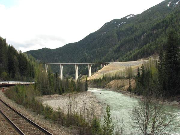 |
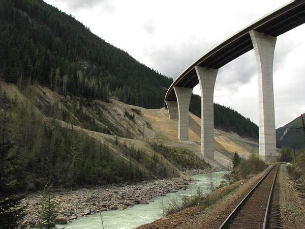
A view from the Rocky Mountaineer train during the afternoon of
May 11th, 2009 of the new 405-metre-long
Park Bridge, between Golden and Yoho Park (site of the Spiral Tunnels) The bridge, which runs 90 metres above the Kicking Horse River and
its approaches, which cost $130 million to construct, now prevent
many fatal accidents which
Up to when they built this bridge, people who used the Trans Canada
couldn�t stop fast enough as they were going
A drive down the newly opened Ten Mile Hill divided freeway portion
of the TransCanada highway in the
|
| This picture was taken and submitted by Massey F. Jones | |
 |
A closer view as we are about to pass under.
Notice the Trans-Canada Highway to the left.
|
| This picture was taken and submitted by Massey F. Jones | |
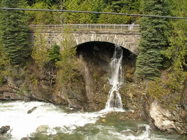 |
An old stone bridge in Albert Canyon, east of Revelstoke BC, probably
dating back to the late-1880s when the CPR pushed West.
Because of the heavy tonnage today, a new track was laid and this well maintained roadway is now most probably a mountain hiking trail. This view was taken from the Rocky Mountaineer on May 11th, 2009. |
| This picture was taken and submitted by Massey F. Jones | |
 |
The Trans Canada Highway bridge near Malakwa BC,
about 10 minutes by rail from Revelstoke BC on May 11th, 2009. It is one of the rare commercial traffic bridges in this mountainous area. |
| This picture was taken and submitted by Massey F. Jones | |
.jpg) |
The attraction is the CN tunnel in the background,
at Hell's Gate BC, so named because the Fraser River narrows to a mere a passage only 35 metres (115 ft.) wide at that point but the pedestrian footbridge is also interesting. Prior to the railway�s arrival, Hell's Gate was an active aboriginal fishing area, located about 130 miles from Vancouver, just south of Boston Bar (for CN) or North Bend, almost across the river, for CP. Both are divisional points for their railway. http://en.wikipedia.org/wiki/Hells_Gate _(British_Columbia) In the 1880s the CPR built a transcontinental track
This view was taken from the Rocky Mountaineer
|
| This picture was taken and submitted by Massey F. Jones |
| Privacy Policy for http://yourrailwaypictures.com/
If you require any more information or have any questions about our privacy policy, please feel free to contact us by us by email at john@summervillens.ca At http://yourrailwaypictures.com/, the privacy of our visitors is of extreme importance to us. This privacy policy document outlines the types of personal information is received and collected by http://yourrailwaypictures.com/ and how it is used. Log Files
Cookies and Web Beacons
DoubleClick DART Cookie
Some of our advertising partners may use cookies and web beacons on
our site. Our advertising partners include ....
These third-party ad servers or ad networks use technology to the advertisements and links that appear on http://yourrailwaypictures.com/ send directly to your browsers. They automatically receive your IP address when this occurs. Other technologies ( such as cookies, JavaScript, or Web Beacons ) may also be used by the third-party ad networks to measure the effectiveness of their advertisements and / or to personalize the advertising content that you see. http://yourrailwaypictures.com/ has no access to or control over these cookies that are used by third-party advertisers. You should consult the respective privacy policies of these third-party ad servers for more detailed information on their practices as well as for instructions about how to opt-out of certain practices. http://yourrailwaypictures.com/'s privacy policy does not apply to, and we cannot control the activities of, such other advertisers or web sites. If you wish to disable cookies, you may do so through your individual browser options. More detailed information about cookie management with specific web browsers can be found at the browsers' respective websites. |